
Camille Kurtz
Full Professor of Computer Science
AI and Computer Vision Researcher
Université Paris Citécamille.kurtz@u-paris.fr


Short bio
Département Informatique (office 705-O)
45 rue des Saints Pères, 75006 Paris (France)
SIP (Systèmes Intelligents de Perception) team
45 rue des Saints Pères, 75006 Paris (France)
I am Full Professor of computer science at Université Paris Cité (France), UFR Mathématiques et Informatique, and researcher at the LIPADE laboratory, where I lead the SIP (Systèmes Intelligents de Perception) team. I supervise scientific projects in AI on pattern recognition, image analysis and computer vision. More precisely, I am interested in the underlying problems related to image representations, with visual, semantic and perceptual aspects. Our research team works on academic projects with state-of-the-art approaches (image segmentation, classification, retrieval, understanding), in thematic areas such as remote sensing, medical or document imaging, or on industrial R&D projects (e.g. CIFRE PhD thesis) with shorter-term methodological contributions. As lecturer, I teach computer sciences (programming, algorithms, artificial vision, image analysis, pattern recognition, etc.) in higher education at different levels (LMD) and I am co-responsible of a Master track about computer vision and intelligent systems.
Short CV
Teaching at the UFR Mathématiques et Informatique ⇒ [since 2022] co-responsible Master VMI (Vision et Machine Intelligente)
Research at the LIPADE, in the SIP (Systèmes Intelligents de Perception) team ⇒ [since 2025] Team leader (formerly Laurent Wendling)
Thesis title: La représentation des images : de la description à l’interprétation
Teaching at the IUT de Paris - Rives de Seine
Research at the LIPADE, in the SIP team
Project: CBIR for medical imaging with semantic representations
Advisor: Daniel L. Rubin
Thesis title: Approche collaborative segmentation-classification pour l'analyse descendante d'images multirésolutions
Advisors: Pierre Gançarski and Nicolas Passat
Teaching assistant at the UFR Mathématiques et Informatique
Check out my academic ancestors (Mathematics Genealogy Project)
Research group
- [since 2025] Head of the SIP team (formerly Laurent Wendling), part of the LIPADE laboratory (Université Paris Cité)
Involvement in academic societies
- [since 2018] Elected member of the Board of the French Association for Pattern Recognition (AFRIF)
- [2022--2026] Elected member of the Board of the Document Analysis Research Group (GRCE)
Habilitation à Diriger des Recherches, HDR
La représentation des images : de la description à l’interprétation
- Christophe Garcia (Rapporteur), Professeur des Universités, INSA de Lyon
- Valérie Gouet-Brunet (Rapporteuse), Directrice de Recherche, IGN
- Henning Müller (Rapporteur), Professeur, Institut Informatique de Gestion, HES-SO Valais-Wallis (Suisse)
- Isabelle Bloch (Examinatrice), Professeure des Universités, Sorbonne Université
- Nicolas Passat (Examinateur), Professeur des Universités, Université de Reims Champagne-Ardenne
- Nicolas Thome (Examinateur), Professeur des Universités, CNAM
- Nicole Vincent (Examinatrice), Professeure des Universités, Université Paris Cité
- Laurent Wendling (Garant scientifique), Professeur des Universités, Université Paris Cité
Projects
I am involved (and I have been involved) in different research projects related to AI, pattern recognition and computer vision:Ongoing projects

|
ANR M2-BDA (2025-2028) Involvement : Co-Principal Investigator Funding : French Agence Nationale de le Recherche Multi-Modal Big Data Analytics: knowledge distillation and deep learning for actionable insights. The goal of M2-BDA is to develop original processing approaches to explore and discover hidden relationships from the combination of diverse types of Earth Observation (in-situ, airborne, satellite, participatory data) multi-modal and multi-scale data. We propose to focus our efforts on learning approaches adapted to massive instrumental data streams, and will concentrate on several key areas: (1) dealing with multi-modal/temporal, and multi-resolution satellite, aerial and in situ data, (2) develop giga-models and self-supervised learning to tackle the lack of labelled data, (3) knowledge distillation to simplify complex models, (4) network explicability to leverage the “black box” of deep learning models for better user understanding. The M2-BDA interdisciplinary project is based on complementary expertise in Computer Sciences (image analysis, pattern recognition, machine learning and data mining and high performance computing) ensured by LIPADE and IRIMAS (in strong collaboration with the HPC of the University of Strasbourg), in environmental geography (land cover/use change analysis) with LIVE and in geoscience with ITES. |

|
ANR High-Vision (2025-2028) Involvement : Co-Principal Investigator Funding : French Agence Nationale de le Recherche Computer vision for a history of early news photo agencies at scale. The High-Vision project aims to advance historical investigations and research in computer vision and artificial intelligence (CVAI) for large collections of historical photographs. It seeks to harness state-of-the-art models for AI training data with a view to shape little-curated photographic archives into digital assets so that they can be investigated by historians, archivists, and the public on a large scale and in innovative ways. The objective of this project is to go beyond state-of-the-art developments in computer vision, focusing on layout segmentation as pre-processing steps, object recognition, image similarity and retrieval followed by metadata enrichment to improve the multimodal indexing steps of images from different data corpora. This High-Vision project will establish a robust pipeline that can effectively trace the circulation of news photographs, document their changing editorial contexts and accurately shape a mass of digitised historical photos without pre-existing metadata into a usable collection. Collaboration: LARCA/LIPADE/Université Paris Cité, LIP6/Sorbonne Université (SU), Maison des Sciences de l’Homme Mondes (UAR 3225), Service Historique de la Défense (SHD), Image Centre (IMC) at Toronto Metropolitan University (TMU). |

|
ANR GEO ReSeT (2023-2027) Involvement : Member (25%) Funding : French Agence Nationale de le Recherche, programme TSIA Generalized Earth Observation with Remote Sensing and Text. This research proposal aims to develop a versatile foundation model for geo-spatial data that can beused for any task and with any data modality. By using location on the Earth's surface as the commonlink between different modalities, the model will be able to incorporate a variety of data sources,including remote sensing imagery, textual descriptions of places, and features in maps. Through self-supervised learning methods such as contrastive learning or multi-modal masked autoencoders, themodel will leverage the large amounts of unlabeled geo-spatial data from these different sources tolearn a better representation of any geo-spatial location and convey a semantic representation of theinformation. |
|
ANR TAMMI (2022-2025) Involvement : Member Funding : ANR JCJC (PI: Sylvain Lobry) Remote sensing images, produced in large quantities, contain information that is already used to monitor climate change, improve security and understand the environment. However, these data are difficult to interpret and often involve manual processing. With the increase in the amount of data, interpretation becomes a limiting factor for the deadlines, but also for the fields in which these can be used. While the data is there, a large audience cannot take advantage of it. As part of the TAMMI project (Text And MultiModal Imagery), our objectives are to facilitate access to the information contained in multimodal data. We propose to use natural language as a way to extract information. For this, we will study shared representations and robustness to missing data. New methods will be proposed to improve the interpretability of predictions made from texts and multimodal data. |
Past projects
|
AI-COLOPREDICT (2021-2024) Involvement : Co-Principal Investigator Funding : INCA - PRTK The AI-COLOPREDICT project is part of the field of digital pathology, which consists of scanning traditional slides of tissue samples in the form of digital images with very high spatial resolution. Determining the prognosis of localized colorectal cancer remains a major clinical problem. Recently, AI has shown its ability to reveal predictive, prognostic or molecular information from a digitized histology slide. Using several prospective cohorts of stage II and III colon cancers involving more than 3,600 patients, the objectives of the project are to generate and validate prognostic algorithms using deep learning technology to estimate patient survival using a slide stained with hematoxilin eosin saffron (HES), less complex staining to achieve. |
|
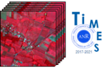
ANR TIMES (2017-2022) Involvement : Co-Principal Investigator Funding : French Agence Nationale de le Recherche The TIMES project aims to support the analysis of satellite image time series in order to monitor the dynamics of our Planet, its land-cover and land-use.The objective of this project is to provide new high-performance processing techniques for mapping and monitoring environmental changes from massive, heterogeneous and high frequency data times series.Our team covers the image processing part of the project, with the main mission of developing and validating novel image analysis methods dedicated to environmental monitoring of landscape objects (e.g. coastal erosion, surface deformation, land cover changes) from the exploitation of the mass of available heterogeneousgeospatial data (aerial and satellite images, point cloud data) acquired with very-high temporal frequency. The ANR TIMES project is a collaboration between recognized teams in Computer Sciences (LIPADE, MIPS,MONASH (Australia) and SERTIT-ICUBE), possessing expertise in image analysis, pattern recognition, machinelearning and high performance computing, and in environmental geography (land cover/use change analysis) withLIVE and ICUBE-SERTIT. |

|
ANR SHADES (2014-2018) Involvement : Member (22 %) Funding : French Agence Nationale de le Recherche The SHADES project is an interdisciplinary project on the security of documents combining experts from computer science and law.The objective of this project is to provide a new tool for authenticating a document through an advanced electronic signature inorder to fight against fraud and falsification. Addressing the drawbacks of current solutions for hybrid document security, thissignature, based on the document’s content and structure, will allow recognizing and authenticating a document independent fromits physical representation as long as its content and/or structure have not been modified. Thanks to a hashing of the document’sinformation during the signature computation, no information from the original document will be deduced from its signature alone.This will be completed by a study on the legal position of this technology and its interest for legal professionals. The project will beconducted in collaboration with a trusted third party and an end user. |
|
ANR Coclico (2012-2017) Involvement : Associated partner (since 2014) Funding : French Agence Nationale de le Recherche The Coclico project ("COllaboration, CLassification, Incrementality and Knowledge")is a research project whose aim is to propose a generic method allowing multi-scale analysis of large volumes of spatio-temporal imaging data of variable quality and provided in continuous with remote sensing technologies over urban areas.It consists in studying and implementing an incremental multistrategy approach guided by knowledge. It must guarantee a final quality of the results by taking into account the qualityof the data and those of knowledge.The Coclico project aims to develop automatic or semi-automatic methods, tailored to the complexity and rapid evolution of large masses of multi-source spatiotemporal data, relying on advanced methodsfrom data mining and the machine learning for the analysis and monitoring of complex phenomena. |
|
ePAD (2012-2013) Involvement : Associated partner Funding : National Institutes of Health (USA) The ePAD project ("electronic Physician Annotation Device")is a medical imaging project launched at Stanford University School of Medicine in 2012 and supported by the National Institutes of Health [grant number U01CA142555-01].Medical images contain a wealth of information, such as anatomy and pathology,which is often not explicit and computationally accessible.Information schemes are being developed to describe the semantic content of images,but such schemes can be unwieldy to operationalize because there are few tools to enable users tocapture structured information easily as part of the routine research workflow.This projects aims at developing a Web-based semantic annotation tool for radiological images called ePad,an open source tool enabling researchers and clinicians to create semantic annotations that are used to characterize images for classification or image retrieval purpose.ePad enables to describe images and image regionsusing a graphical interface (developed with cutting-edge features of GWT-P and HTML5) that maps their descriptions to ontologies. |
|
Project France-Stanford - iCBIR (2014-2015) Involvement : Co-Principal Investigator Funding : France-Stanford Collaborative Projects The goal of the iCBIR project ("Interactive Content-Based Image Retrieval for real-time decision support in Radiology") is to conduct research activities centered on the development of innovative informatics tools that providecomputer-based assistance to radiologists to enhance theirimage interpretation efficiency.Indeed a major challenge to effective Radiology practice is efficiently interpreting cross-sectional studies that contain thousands of images.This results in variability in Radiologist interpretive accuracy and suboptimal patient care.Our tools will assist radiologists by finding, within large image collections, images containing visually similar abnormalities and the associated diagnoses and, where available,responses to therapies. A key aspect of the work will be developing methods of Relevance Feedback to enable the system to continually improve the accuracy of relevant care retrieval during clinical use.We will undertake this work by establishing a collaboration between the Information Sciences in Imaging center (ISIS) at Stanford University, specializing in medical imaging, and the Computer Sciences Laboratory(LIPADE) at University Paris Descartes, possessing expertise in image analysis tools. |
|
ANR Foster (2011 - 2013) Involvement : Involved as Phd student Funding : French Agence Nationale de le Recherche The FOSTER project ("Spatio-temporal data mining: application to the understanding and monitoring of soil erosion")is a three-year project launched in January 2011. This computer science project is founded by the French NationalResearch Agency ANR. This project aims at providing to geologists a semi-automatic and complete process for monitoringsoil erosion. This process will be based on multi-temporal very high resolution satellite images coupled with digitalelevation model (DEM), sensor data and/or expert knowledge. The project will focus more precisely on two importantaspects of this process: segmentation of satellite images based on collaborative methods, and construction of descriptive(patterns, clustering, ...) and predictive (decision trees, ...) spatio-temporal models. |

|
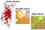
ACI Fodomust (2004 - 2008) Involvement : Involved as Msc student Funding : French Agence Nationale de le Recherche The FoDoMuSt project ("Multi-Strategic Data Mining")is a four-year project launched in September 2004 and finished in September 2008. FoDoMuSt is a research project about multi-strategic data mining forextraction and characterisation of urban vegetation based on a database of remote sensing images.The main idea is to improve the result of one clustering on some data by using a set of clustering methods and making them collaborate.Multi-strategic clustering methods can then be used to generate thematic maps (with different clusters for different ground occupations/uses).The proposed collaborative approaches proposed during this project have been validated in the context of remote sensing images analysis,with the collaboration of the Laboratoire Image et Ville (UMR CNRS/UDS 7011). |
Publications
- Articles in international journals (34)
- Articles in national journals (3)
- Articles in international conferences (56)
- Articles in chapters or books (2)
- Abstracts in international conferences (3)
- Articles in national conferences (21)
A. Research Articles in International Journals
| [1] | (2026) Recognition of action phases from spatio-temporal intermediate representations in amateur sports competition videos, Computer Vision and Image Understanding, XX:XX-XX [BibTeX  ] [DOI ] [DOI  ] [URL ] [URL  ] ] |
BibTeX :
@article{bouacha_CVIU_2026,
   title={Recognition of action phases from spatio-temporal intermediate representations in amateur sports competition videos},
   year={2026},
   journal={Computer Vision and Image Understanding},
   volume={XX},
   pages={XX-XX},
   doi={xxxx},
   author={Bouacha, L. and Magnien, T. and Wendling, L. and Kurtz, C.}
}
|
|
| [2] | (2026) The Forbin dataset: A collection of historical photographs with archival metadata, Journal of Open Humanities Data, XX(X):YY-YY, Ubiquity Press. [BibTeX ] [DOI ] [URL ] |
BibTeX :
@article{chelali_JOHD_2026,
   title={The Forbin dataset: A collection of historical photographs with archival metadata},
   year={2026},
   journal={Journal of Open Humanities Data},
   volume={XX},
   number={X},
   pages={YY--YY},
   publisher={Ubiquity Press},
   doi={},
   author={Chelali, M. and Gosselet, S. and Cloppet, F. and Kurtz, C. and Bloch, I. and Foliard, D.}
}
|
|
| [3] | (2026) A comparative study of computer vision models for oral cancer detection from oral photographs, Computer Methods and Programs in Biomedicine, 275:109198, Elsevier. [BibTeX ] [DOI ] [URL ] |
BibTeX :
@article{chauveron_CMPB_2026,
   title={A comparative study of computer vision models for oral cancer detection from oral photographs},
   year={2026},
   journal={Computer Methods and Programs in Biomedicine},
   volume={275},
   pages={109198},
   publisher={Elsevier},
   doi={https://doi.org/10.1016/j.cmpb.2025.109198},
   author={De Chauveron, J. and Zha, C. and Lescaille, G. and Shaar-Chneker, C. and Brocheriou, I. and Wendling, L. and Kurtz, C. and Rochefort, J.}
}
|
|
| [4] | (2026) Transforming an MRI clinical study database to a structured database adapted to Artificial Intelligence applications, Insights into Imaging, 17(43):25, Elsevier. [BibTeX ] [DOI ] [URL ] |
BibTeX :
@article{sauron_IIM_2026,
   title={Transforming an MRI clinical study database to a structured database adapted to Artificial Intelligence applications},
   year={2026},
   journal={Insights into Imaging},
   volume={17},
   number={43},
   pages={25},
   publisher={Elsevier},
   doi={10.1186/s13244-025-02087-2},
   author={Sauron, T. and Lazarus, C. and Kurtz, C. and Cloppet, F. and Thomassin-Naggara, I. and Fournier, L.}
}
|
|
| [5] | (2026) SpIRL: Spatially-aware image representation learning under the supervision of relative position descriptors, Pattern Recognition, 169:112013, Elsevier. [BibTeX ] [DOI ] [URL ] |
BibTeX :
@article{servant_PR_2026,
   title={SpIRL: Spatially-aware image representation learning under the supervision of relative position descriptors},
   year={2026},
   journal={Pattern Recognition},
   volume={169},
   pages={112013},
   publisher={Elsevier},
   doi={10.1016/J.PATCOG.2025.112013},
   author={Servant, L. and Clément, M. and Wendling, L. and Kurtz, C.}
}
|
|
| [6] | (2025) Multivalued Component Tree: New Results and a Bridge Between Partial and Total Partition Trees, Journal of Mathematical Imaging and Vision, 67(6):57, Springer. [BibTeX ] [DOI ] [URL ] |
BibTeX :
@article{passat_JMIV_2025,
   title={Multivalued Component Tree: New Results and a Bridge Between Partial and Total Partition Trees},
   year={2025},
   journal={Journal of Mathematical Imaging and Vision},
   volume={67},
   number={6},
   pages={57},
   publisher={Springer},
   doi={10.1007/s10851-025-01264-8},
   author={Passat, N. and Perrin, R. and Randrianasoa, J. and Kurtz, C. and Naegel, B.}
}
|
|
| [7] | (2025) Semantic aware representation learning for optimizing image retrieval systems in radiology, Pattern Recognition, 158:111060, Elsevier. [BibTeX ] [DOI ] [URL ] |
BibTeX :
@article{foula_PR_2025,
   title={Semantic aware representation learning for optimizing image retrieval systems in radiology},
   year={2025},
   journal={Pattern Recognition},
   volume={158},
   pages={111060},
   publisher={Elsevier},
   doi={https://doi.org/10.1016/j.patcog.2024.111060},
   author={Vagena, Z. and Wei, X. and Kurtz, C. and Cloppet, F.}
}
|
|
| [8] | (2025) Enhancing vision–language contrastive representation learning using domain knowledge, Computer Vision and Image Understanding, 259:104403 [BibTeX ] [DOI ] [URL ] |
BibTeX :
@article{wei_CVIU_2025,
   title={Enhancing vision–language contrastive representation learning using domain knowledge},
   year={2025},
   journal={Computer Vision and Image Understanding},
   volume={259},
   pages={104403},
   doi={https://doi.org/10.1016/j.cviu.2025.104403},
   author={Wei, X. and Kurtz, C. and Cloppet, F.}
}
|
|
| [9] | (2024) Editorial — Emerging Topics in Pattern Recognition and Artificial Intelligence, World Scientific: Series on Language Processing, Pattern Recognition, and Intelligent Systems, 9:xx-xx [BibTeX ] [DOI ] [URL ] |
BibTeX :
@article{Yacoubi2024,
   title={Editorial — Emerging Topics in Pattern Recognition and Artificial Intelligence},
   year={2024},
   journal={World Scientific: Series on Language Processing, Pattern Recognition, and Intelligent Systems},
   volume={9},
   pages={xx--xx},
   doi={https://doi.org/10.1142/13752},
   author={El-Yacoubi, M. and and Vincent, N. and Kurtz, C.}
}
|
|
| [10] | (2023) Artificial Intelligence for Oral Squamous Cell Carcinoma Detection Based on Oral Photographs: A Comprehensive Literature Review, Cancer Medicine, 00:01-12, Wiley. [BibTeX ] [DOI ] [URL ] |
BibTeX :
@article{chauveron_CM_2023,
   title={Artificial Intelligence for Oral Squamous Cell Carcinoma Detection Based on Oral Photographs: A Comprehensive Literature Review},
   year={2023},
   journal={Cancer Medicine},
   volume={00},
   pages={01-12},
   publisher={Wiley},
   doi={https://doi.org/10.1002/cam4.6822},
   author={De Chauveron, J. and Unger, M. and Lescaille, G. and Wendling, L. and Kurtz, C. and Rochefort, J.}
}
|
|
| [11] | (2022) Description and recognition of complex spatial configurations of object pairs with Force Banner 2D features, Pattern Recognition, 123:108410, Elsevier. [BibTeX ] [DOI ] [URL ] |
BibTeX :
@article{delearde_PR_2022,
   title={Description and recognition of complex spatial configurations of object pairs with Force Banner 2D features},
   year={2022},
   journal={Pattern Recognition},
   volume={123},
   pages={108410},
   publisher={Elsevier},
   doi={https://doi.org/10.1016/j.patcog.2021.108410},
   author={Deléarde, R. and Kurtz, C. and Wendling, L.}
}
|
|
| [12] | (2021) Deep-STaR: Classification of image time series based on spatio-temporal representations, Computer Vision and Image Understanding, 208--209:103221, Elsevier. [BibTeX ] [DOI ] [URL ] |
BibTeX :
@article{chelaliCVIU2021,
   title={Deep-STaR: Classification of image time series based on spatio-temporal representations},
   year={2021},
   journal={Computer Vision and Image Understanding},
   volume={208--209},
   pages={103221},
   publisher={Elsevier},
   doi={10.1016/j.cviu.2021.103221},
   author={Chelali, M. and Kurtz, C. and Puissant, A. and Vincent, N.}
}
|
|
| [13] | (2021) Influence of data representations and deep architectures in image time series classification, International Journal of Pattern Recognition and Artificial Intelligence, 35(12):2160001, World Scientific. [BibTeX ] [DOI ] |
BibTeX :
@article{chelaliIJPRAI2020,
   title={Influence of data representations and deep architectures in image time series classification},
   year={2021},
   journal={International Journal of Pattern Recognition and Artificial Intelligence},
   volume={35},
   number={12},
   pages={2160001},
   publisher={World Scientific},
   doi={10.1142/S0218001421600016},
   author={Chelali, M. and Kurtz, C. and Puissant, A. and Vincent, N.}
}
|
|
| [14] | (2021) Pembrolizumab with Capox Bevacizumab in patients with microsatellite stable metastatic colorectal cancer and a high immune infiltrate: The FFCD 1703-POCHI trial, Digestive and Liver Disease, 53(10):1254-1259, Elsevier. [BibTeX ] [DOI ] [URL ] |
BibTeX :
@article{GALLOIS2021,
   title={Pembrolizumab with Capox Bevacizumab in patients with microsatellite stable metastatic colorectal cancer and a high immune infiltrate: The FFCD 1703-POCHI trial},
   year={2021},
   journal={Digestive and Liver Disease},
   volume={53},
   number={10},
   pages={1254-1259},
   publisher={Elsevier},
   doi={https://doi.org/10.1016/j.dld.2021.06.009},
   author={Gallois, C. and Emile, J.F. and ..,  and Loménie, N. and Kurtz, C. and Taieb, J. and Tougeron, D.}
}
|
|
| [15] | (2021) Supervised quality evaluation of binary partition trees for object segmentation, Pattern Recognition, 111:107667, Elsevier. [BibTeX ] [DOI ] [URL ] |
BibTeX :
@article{randrianasoa_PR_2021,
   title={Supervised quality evaluation of binary partition trees for object segmentation},
   year={2021},
   journal={Pattern Recognition},
   volume={111},
   pages={107667},
   publisher={Elsevier},
   doi={10.1016/j.patcog.2020.107667},
   author={Randrianasoa, T. and Cettour-Janet, P. and Kurtz, C. and Desjardin, E. and Gançarski, P. and Bednarek, N. and Rousseau, F. and Passat, N.}
}
|
|
| [16] | (2021) AGAT: Building and Evaluating Binary Partition Trees for Image Segmentation, SoftwareX, 16:100855, Elsevier. [BibTeX ] [DOI ] [URL ] |
BibTeX :
@article{randrianasoa_SX_2021,
   title={AGAT: Building and Evaluating Binary Partition Trees for Image Segmentation},
   year={2021},
   journal={SoftwareX},
   volume={16},
   pages={100855},
   publisher={Elsevier},
   doi={https://doi.org/10.1016/j.softx.2021.100855},
   author={Randrianasoa, T. and Kurtz, C. and Desjardin, E. and Passat, N.}
}
|
|
| [17] | (2020) Fuzzy Directional Enlacement Landscapes for the Evaluation of Complex Spatial Relations, Pattern Recognition, 101:167-185, Elsevier. [BibTeX ] [DOI ] [URL ] |
BibTeX :
@article{clement_PR_2019,
   title={Fuzzy Directional Enlacement Landscapes for the Evaluation of Complex Spatial Relations},
   year={2020},
   journal={Pattern Recognition},
   volume={101},
   pages={167-185},
   publisher={Elsevier},
   doi={10.1016/j.patcog.2019.107185},
   author={Clément, M. and Kurtz, C. and Wendling, L.}
}
|
|
| [18] | (2020) Editorial — Virtual Special Issue: “Hierarchical Representations: New Results and Challenges for Image Analysis”, Pattern Recognition Letters, 138:201-203 [BibTeX ] [DOI ] [URL ] |
BibTeX :
@article{PASSAT2020201,
   title={Editorial — Virtual Special Issue: “Hierarchical Representations: New Results and Challenges for Image Analysis”},
   year={2020},
   journal={Pattern Recognition Letters},
   volume={138},
   pages={201-203},
   doi={10.1016/j.patrec.2020.07.019},
   author={Passat, N. and Kurtz, C. and Vacavant, A.}
}
|
|
| [19] | (2019) Component-graph construction, Journal of Mathematical Imaging and Vision, 61(6):798-823, Springer. [BibTeX ] |
BibTeX :
@article{passat_JMIV_2019,
   title={Component-graph construction},
   year={2019},
   journal={Journal of Mathematical Imaging and Vision},
   volume={61},
   number={6},
   pages={798-823},
   publisher={Springer},
   author={Passat, N. and Naegel, B. and Kurtz, C.}
}
|
|
| [20] | (2018) Relevance Feedback for Enhancing Content Based Image Retrieval and Automatic Prediction of Semantic Image Features: Application to Bone Tumor Radiographs, Journal of Biomedical Informatics, 84:123-135, Elsevier. [BibTeX ] [DOI ] [URL ] |
BibTeX :
@article{banerjee_JBI_2018,
   title={Relevance Feedback for Enhancing Content Based Image Retrieval and Automatic Prediction of Semantic Image Features: Application to Bone Tumor Radiographs},
   year={2018},
   journal={Journal of Biomedical Informatics},
   volume={84},
   pages={123-135},
   publisher={Elsevier},
   doi={10.1016/j.jbi.2018.07.002},
   author={Banerjee, I. and Kurtz, C. and Devorah, A. and Do, B. and Rubin, D. and Beaulieu, C.}
}
|
|
| [21] | (2018) Learning Spatial Relations and Shapes for Structural Object Description and Scene Recognition, Pattern Recognition, 84:197-2010, Elsevier. [BibTeX ] [DOI ] [URL ] |
BibTeX :
@article{clement_PR_2018,
   title={Learning Spatial Relations and Shapes for Structural Object Description and Scene Recognition},
   year={2018},
   journal={Pattern Recognition},
   volume={84},
   pages={197-2010},
   publisher={Elsevier},
   doi={10.1016/j.patcog.2018.06.017},
   author={Clément, M. and Kurtz, C. and Wendling, L.}
}
|
|
| [22] | (2018) Binary Partition Tree Construction from Multiple Features for Image Segmentation, Pattern Recognition, 84:237-250, Elsevier. [BibTeX ] [DOI ] [URL ] |
BibTeX :
@article{randrianasoa_PR_2018,
   title={Binary Partition Tree Construction from Multiple Features for Image Segmentation},
   year={2018},
   journal={Pattern Recognition},
   volume={84},
   pages={237-250},
   publisher={Elsevier},
   doi={10.1016/j.patcog.2018.07.003},
   author={Randrianasoa, T. and Kurtz, C. and Desjardin, E. and Passat, N.}
}
|
|
| [23] | (2017) Directional Enlacement Histograms for the Description of Complex Spatial Configurations between Objects, IEEE Transactions on Pattern Analysis and Machine Intelligence, 39(12):2366-2380, IEEE Computer Society. [BibTeX ] [DOI ] [URL ] |
BibTeX :
@article{clement_PAMI_2017,
   title={Directional Enlacement Histograms for the Description of Complex Spatial Configurations between Objects},
   year={2017},
   journal={IEEE Transactions on Pattern Analysis and Machine Intelligence},
   volume={39},
   number={12},
   pages={2366-2380},
   publisher={IEEE Computer Society},
   doi={10.1109/TPAMI.2016.2645151},
   author={Clément, M. and Poulenard, A. and Kurtz, C. and Wendling, L.}
}
|
|
| [24] | (2015) Tree leaves extraction in natural images: Comparative study of pre-processing tools and segmentation methods, IEEE Transactions on Image Processing, 24(5):1549-1560, IEEE Signal Processing Society. [BibTeX ] [DOI ] [URL ] |
BibTeX :
@article{grandbrochier_TIP_2015,
   title={Tree leaves extraction in natural images: Comparative study of pre-processing tools and segmentation methods},
   year={2015},
   journal={IEEE Transactions on Image Processing},
   volume={24},
   number={5},
   pages={1549-1560},
   publisher={IEEE Signal Processing Society},
   doi={10.1109/TIP.2015.2400214},
   author={Grand-Brochier, M. and Vacavant, A. and Cerutti, G. and Kurtz, C. and Weber, J. and Tougne, L.}
}
|
|
| [25] | (2014) Predicting Visual Semantic Descriptive Terms from Radiological Image Data: Preliminary Results with Liver Lesions in CT, IEEE Transactions on Medical Imaging, 33(8):1669-1676, IEEE Signal Processing Society. [BibTeX ] [DOI ] [URL ] |
BibTeX :
@article{depeursinge_TMI_2014,
   title={Predicting Visual Semantic Descriptive Terms from Radiological Image Data: Preliminary Results with Liver Lesions in CT},
   year={2014},
   journal={IEEE Transactions on Medical Imaging},
   volume={33},
   number={8},
   pages={1669-1676},
   publisher={IEEE Signal Processing Society},
   doi={10.1109/TMI.2014.2321347},
   author={Depeursinge, A. and Kurtz, C. and Napel, S. and Beaulieu, C. and Rubin, D.}
}
|
|
| [26] | (2014) A hierarchical knowledge-based approach for retrieving similar medical images described with semantic annotations, Journal of Biomedical Informatics, 49(1):227-244, Elsevier. [BibTeX ] [DOI ] [URL ] |
BibTeX :
@article{kurtz_JBI_2014,
   title={A hierarchical knowledge-based approach for retrieving similar medical images described with semantic annotations},
   year={2014},
   journal={Journal of Biomedical Informatics},
   volume={49},
   number={1},
   pages={227-244},
   publisher={Elsevier},
   doi={10.1016/j.jbi.2014.02.018},
   author={Kurtz, C. and Beaulieu, C. and Napel, S. and Rubin, D.}
}
|
|
| [27] | (2014) On combining image-based and ontological semantic dissimilarities for medical image retrieval applications, Medical Image Analysis, 18(7):1082-1100, Elsevier. [BibTeX ] [DOI ] [URL ] |
BibTeX :
@article{kurtz_MIA_2014,
   title={On combining image-based and ontological semantic dissimilarities for medical image retrieval applications},
   year={2014},
   journal={Medical Image Analysis},
   volume={18},
   number={7},
   pages={1082-1100},
   publisher={Elsevier},
   doi={10.1016/j.media.2014.06.009},
   author={Kurtz, C. and Depeursinge, A. and Napel, S. and Beaulieu, C. and Rubin, D.}
}
|
|
| [28] | (2014) Connected Filtering Based on Multivalued Component-Trees, IEEE Transactions on Image Processing, 23(12):5152-5164, IEEE Signal Processing Society. [BibTeX ] [DOI ] [URL ] |
BibTeX :
@article{kurtz_TIP_2014,
   title={Connected Filtering Based on Multivalued Component-Trees},
   year={2014},
   journal={IEEE Transactions on Image Processing},
   volume={23},
   number={12},
   pages={5152-5164},
   publisher={IEEE Signal Processing Society},
   doi={10.1109/TIP.2014.2362053},
   author={Kurtz, C. and Naegel, B. and Passat, N.}
}
|
|
| [29] | (2014) Hierarchical extraction of landslides from multiresolution remotely sensed optical images, ISPRS Journal of Photogrammetry and Remote Sensing, 87(1):122-136, Elsevier. [BibTeX ] [DOI ] [URL ] |
BibTeX :
@article{kurtz_ISPRS_2014,
   title={Hierarchical extraction of landslides from multiresolution remotely sensed optical images},
   year={2014},
   journal={ISPRS Journal of Photogrammetry and Remote Sensing},
   volume={87},
   number={1},
   pages={122-136},
   publisher={Elsevier},
   doi={10.1016/j.isprsjprs.2013.11.003},
   author={Kurtz, C. and Stumpf, A. and Malet, J. and Gançarski, P. and Puissant, A. and Passat, N.}
}
|
|
| [30] | (2014) Automated tracking of quantitative assessments of tumor burden in clinical trials, Translational Oncology, 7(1):1-16, Elsevier. [BibTeX ] [DOI ] [URL ] |
BibTeX :
@article{kurtz_TO_2014,
   title={Automated tracking of quantitative assessments of tumor burden in clinical trials},
   year={2014},
   journal={Translational Oncology},
   volume={7},
   number={1},
   pages={1-16},
   publisher={Elsevier},
   doi={10.1593/tlo.13796},
   author={Rubin, D. and Willrett, D. and O'Connor, M. and Hage, C. and Kurtz, C. and Moreira, D.}
}
|
|
| [31] | (2013) A hierarchical semantic-based distance for nominal histogram comparison, Data and Knowledge Engineering, 87(1):206-225, Elsevier. [BibTeX ] [DOI ] [URL ] |
BibTeX :
@article{kurtz_DKE_2013,
   title={A hierarchical semantic-based distance for nominal histogram comparison},
   year={2013},
   journal={Data and Knowledge Engineering},
   volume={87},
   number={1},
   pages={206-225},
   publisher={Elsevier},
   doi={10.1016/j.datak.2013.06.002},
   author={Kurtz, C. and Gançarski, P. and Passat, N. and Puissant, A.}
}
|
|
| [32] | (2012) Extraction of complex patterns from multiresolution remote sensing images: A hierarchical top-down methodology, Pattern Recognition, 45(2):685-706, Elsevier. [BibTeX ] [DOI ] [URL ] |
BibTeX :
@article{kurtz_PR_2012,
   title={Extraction of complex patterns from multiresolution remote sensing images: A hierarchical top-down methodology},
   year={2012},
   journal={Pattern Recognition},
   volume={45},
   number={2},
   pages={685-706},
   publisher={Elsevier},
   doi={10.1016/j.patcog.2011.07.017},
   author={Kurtz, C. and Passat, N. and Gançarski, P. and Puissant, A.}
}
|
|
| [33] | (2012) Spatio-temporal reasoning for the classification of satellite image time series, Pattern Recognition Letters, 33(13):1805-1815, Elsevier. [BibTeX ] [DOI ] [URL ] |
BibTeX :
@article{petitjean_PRL_2012,
   title={Spatio-temporal reasoning for the classification of satellite image time series},
   year={2012},
   journal={Pattern Recognition Letters},
   volume={33},
   number={13},
   pages={1805-1815},
   publisher={Elsevier},
   doi={10.1016/j.patrec.2012.06.009},
   author={Petitjean, F. and Kurtz, C. and Passat, N. and Gançarski, P.}
}
|
|
| [34] | (2010) Multiresolution region-based clustering for urban analysis, International Journal of Remote Sensing, 31(22):5941-5973, Taylor and Francis. [BibTeX ] [DOI ] [URL ] |
BibTeX :
@article{kurtz_IJRS_2010,
   title={Multiresolution region-based clustering for urban analysis},
   year={2010},
   journal={International Journal of Remote Sensing},
   volume={31},
   number={22},
   pages={5941-5973},
   publisher={Taylor and Francis},
   doi={10.1080/01431161.2010.512312},
   author={Kurtz, C. and Passat, N. and Gançarski, P. and Puissant, A.}
}
|
B. Research Articles in National Journals
| [1] | (2023) Pathologie numérique et intelligence artificielle à l’ère de la médecine de précision, Revue Immunité \& Cancer, 7(3):19-35, . [BibTeX ] [URL ] |
BibTeX :
@article{ZENG_IC_2023,
   title={Pathologie numérique et intelligence artificielle à l’ère de la médecine de précision},
   year={2023},
   journal={Revue Immunité \& Cancer},
   volume={7},
   number={3},
   pages={19-35},
   publisher={},
   author={Zeng, Q. and ..,  and Kurtz, C. and Loménie, N.}
}
|
|
| [2] | (2016) Description d’objets en couleurs à partir des relations spatiales entre régions structurelles, Revue des Nouvelles Technologies de l'Information, Fouille de Données Complexes, RNTI-E-31 [BibTeX ] [URL ] |
BibTeX :
@article{clement_RNTI_2016,
   title={Description d’objets en couleurs à partir des relations spatiales entre régions structurelles},
   year={2016},
   journal={Revue des Nouvelles Technologies de l'Information},
   volume={Fouille de Données Complexes, RNTI-E-31},
   author={Clément, M. and Kurtz, C. and Wendling, L.}
}
|
|
| [3] | (2014) Approches multi-hiérarchiques pour l'analyse d'images de télédétection, Revue Française de Photogrammétrie et de Télédétection, 14(205):19-35, SFPT. [BibTeX ] [URL ] |
BibTeX :
@article{kurtz_RFPT_2014,
   title={Approches multi-hiérarchiques pour l'analyse d'images de télédétection},
   year={2014},
   journal={Revue Française de Photogrammétrie et de Télédétection},
   volume={14},
   number={205},
   pages={19-35},
   publisher={SFPT},
   author={Kurtz, C. and Gançarski, P. and Puissant, A. and Passat, N.}
}
|
C. Research Articles in International Conference or Workshops Proceedings
| [1] | (2026) RAMEN: Resolution-Adjustable Multimodal Encoder for Earth Observation, In Proceedings of the Conference on Computer Vision and Pattern Recognition -- CVPR 2026, pages XX-XX, IEEE/CVF. Denver (Colorado, US). Long paper. [BibTeX ] [DOI ] [URL ] |
BibTeX :
@inproceedings{houdre_CVPR_2026,
   title={RAMEN: Resolution-Adjustable Multimodal Encoder for Earth Observation},
   year={2026},
   booktitle={Proceedings of the Conference on Computer Vision and Pattern Recognition -- CVPR 2026},
   month={June},
   address={Denver (Colorado, US)},
   pages={XX--XX},
   publisher={IEEE/CVF},
   doi={},
   author={Houdré, N. and Marcos, D. and Turckheim, H.R.d. and Ienco, D. and Wendling, L. and Kurtz, C. and Lobry, S.}
}
|
|
| [2] | (2026) QwenCLIP: Boosting Medical Vision-Language Model Pretraining via LLM Embeddings and Prompt Tuning, In Proceedings of the IEEE International Symposium on Biomedical Imaging -- ISBI 2026, pages xx-xx, IEEE Computer Society. London (UK). Long paper. [BibTeX ] [DOI ] [URL ] |
BibTeX :
@inproceedings{wei_ISBI_2026,
   title={QwenCLIP: Boosting Medical Vision-Language Model Pretraining via LLM Embeddings and Prompt Tuning},
   year={2026},
   booktitle={Proceedings of the IEEE International Symposium on Biomedical Imaging -- ISBI 2026},
   month={April},
   address={London (UK)},
   pages={xx--xx},
   publisher={IEEE Computer Society},
   doi={},
   author={Wei, X. and Kurtz, C. and Cloppet, F.}
}
|
|
| [3] | (2025) LLM-Driven Data Augmentation for Visual Question Answering, In Proceedings of the IEEE Joint Urban Remote Sensing Event -- JURSE 2025, pages 1-4, IEEE Geoscience and Remote Sensing Society. Tunis (Tunisia). Long paper. [BibTeX ] [DOI ] [URL ] |
BibTeX :
@inproceedings{boussaid_JURSE_2025,
   title={LLM-Driven Data Augmentation for Visual Question Answering},
   year={2025},
   booktitle={Proceedings of the IEEE Joint Urban Remote Sensing Event -- JURSE 2025},
   month={May},
   address={Tunis (Tunisia)},
   pages={1-4},
   publisher={IEEE Geoscience and Remote Sensing Society},
   doi={10.1109/JURSE60372.2025.11076083},
   author={Boussaid, H. and Kwon, N. and Kurtz, C. and Wendling, L. and Lobry, S.}
}
|
|
| [4] | (2025) Visual Question Answering on Multiple Remote Sensing Image Modalities, In Proceedings of the Large Scale Computer Vision for Remote Sensing Imagery Workshop -- EarthVision@CVPR 2025, pages 2319-2328 Nashville (Tennessee, US). Long paper. [BibTeX ] [DOI ] [URL ] |
BibTeX :
@inproceedings{boussaid_earthvision_2025,
   title={Visual Question Answering on Multiple Remote Sensing Image Modalities},
   year={2025},
   booktitle={Proceedings of the Large Scale Computer Vision for Remote Sensing Imagery Workshop -- EarthVision@CVPR 2025},
   address={Nashville (Tennessee, US)},
   pages={2319-2328},
   doi={},
   author={Boussaid, H. and Tosato, L. and Weissgerber, F. and Kurtz, C. and Wendling, L. and Lobry, S.}
}
|
|
| [5] | (2025) Automating Geospatial Vision Tasks with a Large Language Model Agent, In Proceedings of the European Conference on Machine Learning and Principles and Practice of Knowledge Discovery in Databases -- ECML-PKDD 2025, pages 218-235 Porto (Portugal). Long paper (oral presentation). [BibTeX ] [DOI ] [URL ] |
BibTeX :
@inproceedings{Chen_ecmlpkdd_2025,
   title={Automating Geospatial Vision Tasks with a Large Language Model Agent},
   year={2025},
   booktitle={Proceedings of the European Conference on Machine Learning and Principles and Practice of Knowledge Discovery in Databases -- ECML-PKDD 2025},
   address={Porto (Portugal)},
   pages={218-235},
   doi={10.1007/978-3-662-72243-5\_13},
   author={Chen, Y. and Wang, W. and Kurtz, C. and Lobry, S.}
}
|
|
| [6] | (2025) ProMM-RS: Exploring Probabilistic learning for Multi-Modal Remote Sensing Image Representations, In Proceedings of the Workshop on Computer Vision for Geospatial Image Analysis -- GeoCV@WACV 2025, pages 517-525, IEEE Computer Society. Tucson (Arizona, US). Long paper. [BibTeX ] [DOI ] [URL ] |
BibTeX :
@inproceedings{houdre_GeoCV_2025,
   title={ProMM-RS: Exploring Probabilistic learning for Multi-Modal Remote Sensing Image Representations},
   year={2025},
   booktitle={Proceedings of the Workshop on Computer Vision for Geospatial Image Analysis -- GeoCV@WACV 2025},
   month={March},
   address={Tucson (Arizona, US)},
   pages={517-525},
   publisher={IEEE Computer Society},
   doi={},
   author={Houdré, N. and Marcos, D. and Ienco, D. and Wendling, L. and Kurtz, C. and Lobry, S.}
}
|
|
| [7] | (2025) Contrastive learning of image representations guided by spatial relations, In Proceedings of the IEEE/CVF Winter Conference on Applications of Computer Vision -- WACV 2025, pages 2124-2133, IEEE Computer Society. Tucson (Arizona, US). Long paper (oral presentation). [BibTeX ] [DOI ] [URL ] |
BibTeX :
@inproceedings{servant_WACV_2025,
   title={Contrastive learning of image representations guided by spatial relations},
   year={2025},
   booktitle={Proceedings of the IEEE/CVF Winter Conference on Applications of Computer Vision -- WACV 2025},
   month={March},
   address={Tucson (Arizona, US)},
   pages={2124-2133},
   publisher={IEEE Computer Society},
   doi={10.1109/WACV61041.2025.00213},
   author={Servant, L. and Clément, M. and Wendling, L. and Kurtz, C.}
}
|
|
| [8] | (2025) A Semantically-Aware Relevance Measure for Content-Based Medical Image Retrieval Evaluation, In Proceedings of the International Conference on Image Analysis and Processing -- ICIAP 2025, pages xx-xx, IEEE Computer Society. Rome (Italy). Long paper. [BibTeX ] [DOI ] [URL ] |
BibTeX :
@inproceedings{wei_ICIAP_2025,
   title={A Semantically-Aware Relevance Measure for Content-Based Medical Image Retrieval Evaluation},
   year={2025},
   booktitle={Proceedings of the International Conference on Image Analysis and Processing -- ICIAP 2025},
   month={September},
   address={Rome (Italy)},
   pages={xx--xx},
   publisher={IEEE Computer Society},
   doi={},
   author={Wei, X. and Kurtz, C. and Cloppet, F.}
}
|
|
| [9] | (2025) Relaxing Binary Constraints in Contrastive Vision-Language Medical Representation Learning, In Proceedings of the IEEE/CVF Winter Conference on Applications of Computer Vision -- WACV 2025, pages 4462-4471, IEEE Computer Society. Tucson (Arizona, US). Long paper (poster presentation). [BibTeX ] [DOI ] [URL ] |
BibTeX :
@inproceedings{wei_WACV_2025,
   title={Relaxing Binary Constraints in Contrastive Vision-Language Medical Representation Learning},
   year={2025},
   booktitle={Proceedings of the IEEE/CVF Winter Conference on Applications of Computer Vision -- WACV 2025},
   month={March},
   address={Tucson (Arizona, US)},
   pages={4462-4471},
   publisher={IEEE Computer Society},
   doi={10.1109/WACV61041.2025.00438},
   author={Wei, X. and Kurtz, C. and Cloppet, F.}
}
|
|
| [10] | (2024) Lymphoid infiltration assessment of the tumor margins in HES slides, In Proceedings of the Medical Optical Imaging and Virtual Microscopy Image Analysis Workshop -- MOVI@MICCAI 2024, pages 1-4 Marrakesh (Morocco). Long paper. [BibTeX ] [DOI ] [URL ] |
BibTeX :
@inproceedings{guo_MOVI_2024,
   title={Lymphoid infiltration assessment of the tumor margins in HES slides},
   year={2024},
   booktitle={Proceedings of the Medical Optical Imaging and Virtual Microscopy Image Analysis Workshop -- MOVI@MICCAI 2024},
   address={Marrakesh (Morocco)},
   pages={1-4},
   doi={10.1109/ISBI56570.2024.10635338},
   author={Guo, Z. and Marzouki, A. and Emile, J.F. and Müller, H. and Kurtz, C. and Loménie, N.}
}
|
|
| [11] | (2024) Optimizing lymphocyte detection in breast cancer whole slide imaging through data-centric strategies, In Proceedings of the IEEE International Symposium on Biomedical Imaging -- ISBI 2024, pages 1-4, IEEE Computer Society. Athens (Greece). Long paper. [BibTeX ] [DOI ] [URL ] |
BibTeX :
@inproceedings{marzouki_ISBI_2024,
   title={Optimizing lymphocyte detection in breast cancer whole slide imaging through data-centric strategies},
   year={2024},
   booktitle={Proceedings of the IEEE International Symposium on Biomedical Imaging -- ISBI 2024},
   month={May},
   address={Athens (Greece)},
   pages={1-4},
   publisher={IEEE Computer Society},
   doi={10.1109/ISBI56570.2024.10635338},
   author={Marzouki, A. and Guo, Z. and Zeng, Q. and Kurtz, C. and Loménie, N.}
}
|
|
| [12] | (2024) Investigating staining variance effects on deep learning-based semantic segmentation in digital pathology, In Proceedings of the SPIE Medical Imaging -- SPIE MED IM 2024, pages 1-5, SPIE. San Diego (USA). Long paper. [BibTeX ] [DOI ] |
BibTeX :
@inproceedings{marzouki_SPIE_2024,
   title={Investigating staining variance effects on deep learning-based semantic segmentation in digital pathology},
   year={2024},
   booktitle={Proceedings of the SPIE Medical Imaging -- SPIE MED IM 2024},
   month={February},
   address={San Diego (USA)},
   pages={1-5},
   publisher={SPIE},
   doi={http://dx.doi.org/10.1117/12.3006724},
   author={Marzouki, A. and Vagena, Z. and Kurtz, C. and Loménie, N.}
}
|
|
| [13] | (2024) New Algorithms For Multivalued Component-Trees, In Proceedings of the IEEE International Conference on Pattern Recognition -- ICPR 2024, pages 19-35 Kolkata (India). Long paper. [BibTeX ] [DOI ] [URL ] |
BibTeX :
@inproceedings{perrin_ICPR_2024,
   title={New Algorithms For Multivalued Component-Trees},
   year={2024},
   booktitle={Proceedings of the IEEE International Conference on Pattern Recognition -- ICPR 2024},
   address={Kolkata (India)},
   pages={19-35},
   doi={10.1007/978-3-031-78347-0\_2},
   author={Passat, N. and Perrin, R. and Randrianasoa, J. and Kurtz, C. and Naegel, B.}
}
|
|
| [14] | (2024) SEQ-ALIGN: Self-supervised image representation learning from multi-sequence MRI, In Proceedings of the IEEE International Symposium on Biomedical Imaging -- ISBI 2024, pages 1-4, IEEE Computer Society. Athens (Greece). Long paper. [BibTeX ] [DOI ] [URL ] |
BibTeX :
@inproceedings{sauron_ISBI_2024,
   title={SEQ-ALIGN: Self-supervised image representation learning from multi-sequence MRI},
   year={2024},
   booktitle={Proceedings of the IEEE International Symposium on Biomedical Imaging -- ISBI 2024},
   month={May},
   address={Athens (Greece)},
   pages={1-4},
   publisher={IEEE Computer Society},
   doi={10.1109/ISBI56570.2024.10635498},
   author={Sauron, T. and Lazarus, C. and Fournier, L. and Kurtz, C. and Cloppet, F.}
}
|
|
| [15] | (2024) Segmentation-guided attention for visual question answering from remote sensing images, In Proceedings of the IEEE International Geoscience and Remote Sensing Symposium -- IGARSS 2024, pages 2750-2754, IEEE Geoscience and Remote Sensing Society. Athens (Greece). Long paper. [BibTeX ] [DOI ] [URL ] |
BibTeX :
@inproceedings{tosato_IGARSS_2024,
   title={Segmentation-guided attention for visual question answering from remote sensing images},
   year={2024},
   booktitle={Proceedings of the IEEE International Geoscience and Remote Sensing Symposium -- IGARSS 2024},
   month={July},
   address={Athens (Greece)},
   pages={2750-2754},
   publisher={IEEE Geoscience and Remote Sensing Society},
   doi={10.1109/IGARSS53475.2024.10642082},
   author={Tosato, L. and Boussaid, H. and Weissgerber, F. and Kurtz, C. and Wendling, L. and Lobry, S.}
}
|
|
| [16] | (2024) Integrating expert knowledge with vision-language model to improve medical image retrieval, In Proceedings of the IEEE International Symposium on Biomedical Imaging -- ISBI 2024, pages 1-4, IEEE Computer Society. Athens (Greece). Long paper. [BibTeX ] [DOI ] [URL ] |
BibTeX :
@inproceedings{wei_ISBI_2024,
   title={Integrating expert knowledge with vision-language model to improve medical image retrieval},
   year={2024},
   booktitle={Proceedings of the IEEE International Symposium on Biomedical Imaging -- ISBI 2024},
   month={May},
   address={Athens (Greece)},
   pages={1-4},
   publisher={IEEE Computer Society},
   doi={10.1109/ISBI56570.2024.10635576},
   author={Wei, X. and Vagena, Z. and Kurtz, C. and Cloppet, F.}
}
|
|
| [17] | (2023) Hierarchical Transformer Encoder to Improve Entire Neoplasm Area Segmentation on Whole Slide Image of Hepatocellular Carcinoma, In Proceedings of the IEEE International Symposium on Biomedical Imaging -- ISBI 2023, pages 1-5, IEEE Computer Society. Cartagena de Indias (Colombia). Long paper. [BibTeX ] [DOI ] |
BibTeX :
@inproceedings{guo_ISBI_2023,
   title={Hierarchical Transformer Encoder to Improve Entire Neoplasm Area Segmentation on Whole Slide Image of Hepatocellular Carcinoma},
   year={2023},
   booktitle={Proceedings of the IEEE International Symposium on Biomedical Imaging -- ISBI 2023},
   month={April},
   address={Cartagena de Indias (Colombia)},
   pages={1-5},
   publisher={IEEE Computer Society},
   doi={https://doi.org/10.1109/ISBI53787.2023.10230568},
   author={Guo, Z. and Wang, Q. and Müller, H. and Palpanas, T. and Loménie, N. and Kurtz, C.}
}
|
|
| [18] | (2023) Learning representations for MR image retrieval: Contrastive models versus other supervision strategies, In Proceedings of the IEEE International Symposium on Biomedical Imaging -- ISBI 2023, pages 1-5, IEEE Computer Society. Cartagena de Indias (Colombia). Long paper. [BibTeX ] [DOI ] |
BibTeX :
@inproceedings{sauron_ISBI_2023,
   title={Learning representations for MR image retrieval: Contrastive models versus other supervision strategies},
   year={2023},
   booktitle={Proceedings of the IEEE International Symposium on Biomedical Imaging -- ISBI 2023},
   month={April},
   address={Cartagena de Indias (Colombia)},
   pages={1-5},
   publisher={IEEE Computer Society},
   doi={https://doi.org/10.1109/ISBI53787.2023.10230339},
   author={Sauron, T. and Lazarus, C. and Kurtz, C. and Cloppet, F.}
}
|
|
| [19] | (2023) An extension of the Radial Line Model to predict spatial relations, In Proceedings of the International Conference on Computer Vision Theory and Applications -- VISAPP 2023, pages 187-195, SCITEPRESS Digital Library. Lisbon (Portugal). Short paper. [BibTeX ] [DOI ] |
BibTeX :
@inproceedings{servant_VISAP_2023,
   title={An extension of the Radial Line Model to predict spatial relations},
   year={2023},
   booktitle={Proceedings of the International Conference on Computer Vision Theory and Applications -- VISAPP 2023},
   month={February},
   address={Lisbon (Portugal)},
   pages={187-195},
   publisher={SCITEPRESS Digital Library},
   doi={https://doi.org/10.5220/0011644300003417},
   author={Servant, L. and Kurtz, C. and Wendling, L.}
}
|
|
| [20] | (2022) Fine-tune your classifier: Finding correlations with temperature, In Proceedings of the IEEE International Conference on Image Processing -- ICIP 2022, pages 2766-2770, IEEE Computer Society. Bordeaux (France). Long paper. [BibTeX ] [DOI ] [URL ] |
BibTeX :
@inproceedings{risser-maroix_ICIP_2022,
   title={Fine-tune your classifier: Finding correlations with temperature},
   year={2022},
   booktitle={Proceedings of the IEEE International Conference on Image Processing -- ICIP 2022},
   month={October},
   address={Bordeaux (France)},
   pages={2766-2770},
   publisher={IEEE Computer Society},
   doi={10.1109/ICIP46576.2022.9897735},
   author={Chamand, B. and Risser-Maroix, O. and Kurtz, C. and Joly, P. and Loménie, N.}
}
|
|
| [21] | (2022) Dealing with incomplete land-cover database annotations applied to satellite image time series semantic segmentation, In Proceedings of the International Conference on Pattern Recognition and Artificial Intelligence -- ICPRAI 2022, 13296:211-222, Springer. Paris (France). Long paper. [BibTeX ] |
BibTeX :
@inproceedings{colomines_ICPRAI_2022,
   title={Dealing with incomplete land-cover database annotations applied to satellite image time series semantic segmentation},
   year={2022},
   booktitle={Proceedings of the International Conference on Pattern Recognition and Artificial Intelligence -- ICPRAI 2022},
   volume={13296},
   editor={El-Yacoubi, M.e.a.},
   month={June},
   address={Paris (France)},
   pages={211-222},
   publisher={Springer},
   author={Colomines, L. and Kurtz, C. and Puissant, A. and Vincent, N.}
}
|
|
| [22] | (2022) Embedding spatial relations in Visual Question Answering for remote sensing, In Proceedings of the IEEE International Conference on Pattern Recognition -- ICPR 2022, pages 310-316, IEEE Computer Society. Montréal (Canada). Long paper. [BibTeX ] |
BibTeX :
@inproceedings{faure_ICPR_2022,
   title={Embedding spatial relations in Visual Question Answering for remote sensing},
   year={2022},
   booktitle={Proceedings of the IEEE International Conference on Pattern Recognition -- ICPR 2022},
   month={January},
   address={Montréal (Canada)},
   pages={310-316},
   publisher={IEEE Computer Society},
   author={Faure, M. and Lobry, S. and Kurtz, C. and Wendling, L.}
}
|
|
| [23] | (2022) Hologram detection for identity document authentication, In Proceedings of the International Conference on Pattern Recognition and Artificial Intelligence -- ICPRAI 2022, 13296:346-357, Springer. Paris (France). Long paper. [BibTeX ] |
BibTeX :
@inproceedings{kada_ICPRAI_2022,
   title={Hologram detection for identity document authentication},
   year={2022},
   booktitle={Proceedings of the International Conference on Pattern Recognition and Artificial Intelligence -- ICPRAI 2022},
   volume={13296},
   editor={El-Yacoubi, M.e.a.},
   month={June},
   address={Paris (France)},
   pages={346-357},
   publisher={Springer},
   author={Kada, O. and Kurtz, C. and van Kieu, C. and Vincent, N.}
}
|
|
| [24] | (2022) Discovering respects for visual similarity, In Proceedings of the IAPR Joint International Workshops on Statistical, Structural and Syntactic Techniques Pattern in Recognition -- S+SSPR 2022, 13813:1-10, Springer. Montréal (Cananda). Long paper. [BibTeX ] [DOI ] |
BibTeX :
@inproceedings{risser-maroix_SSPR_2022,
   title={Discovering respects for visual similarity},
   year={2022},
   booktitle={Proceedings of the IAPR Joint International Workshops on Statistical, Structural and Syntactic Techniques Pattern in Recognition -- S+SSPR 2022},
   volume={13813},
   month={August},
   address={Montréal (Cananda)},
   pages={1-10},
   publisher={Springer},
   doi={https://doi.org/10.1007/978-3-031-23028-8_14},
   author={Risser-Maroix, O. and Kurtz, C. and Loménie, N.}
}
|
|
| [25] | (2022) Text-guided visual representation learning for medical image retrieval systems, In Proceedings of the IEEE International Conference on Pattern Recognition -- ICPR 2022, pages 593-598, IEEE Computer Society. Montréal (Canada). Long paper. [BibTeX ] |
BibTeX :
@inproceedings{serieys_ICPR_2022,
   title={Text-guided visual representation learning for medical image retrieval systems},
   year={2022},
   booktitle={Proceedings of the IEEE International Conference on Pattern Recognition -- ICPR 2022},
   month={January},
   address={Montréal (Canada)},
   pages={593-598},
   publisher={IEEE Computer Society},
   author={Sérieys, G. and Kurtz, C. and Fournier, L. and Cloppet, F.}
}
|
|
| [26] | (2021) Violence detection from video under 2D spatio-temporal representations, In Proceedings of the IEEE International Conference on Image Processing -- ICIP 2021, pages 2593-2597, IEEE Computer Society. Anchorage (Alaska, US). Long paper. [BibTeX ] [DOI ] |
BibTeX :
@inproceedings{chelali_ICIP_2021,
   title={Violence detection from video under 2D spatio-temporal representations},
   year={2021},
   booktitle={Proceedings of the IEEE International Conference on Image Processing -- ICIP 2021},
   month={September},
   address={Anchorage (Alaska, US)},
   pages={2593-2597},
   publisher={IEEE Computer Society},
   doi={https://doi.org/10.1109/ICIP42928.2021.9506142},
   author={Chelali, M. and Kurtz, C. and Vincent, N.}
}
|
|
| [27] | (2021) Segment my object: A pipeline to extract segmented objects in images based on labels or bounding boxes, In Proceedings of the International Conference on Computer Vision Theory and Applications -- VISAPP 2021, pages 618-625, SCITEPRESS Digital Library. Vienna (Austria). Short paper. [BibTeX ] [DOI ] |
BibTeX :
@inproceedings{delearde_VISAP_2021,
   title={Segment my object: A pipeline to extract segmented objects in images based on labels or bounding boxes},
   year={2021},
   booktitle={Proceedings of the International Conference on Computer Vision Theory and Applications -- VISAPP 2021},
   month={February},
   address={Vienna (Austria)},
   pages={618-625},
   publisher={SCITEPRESS Digital Library},
   doi={10.5220/0010324006180625},
   author={Deléarde, R. and Kurtz, C. and Dejean, P. and Wendling, L.}
}
|
|
| [28] | (2021) Combination of visual and semantic criteria for automated selection of region proposals in a bounding box, In Proceedings of the International Conference on Computer Machine Vision -- ICMV 2021, pages 230-238, SPIE. Rome (Italy). Long paper. [BibTeX ] [DOI ] |
BibTeX :
@inproceedings{leghettas_ICMV_2021,
   title={Combination of visual and semantic criteria for automated selection of region proposals in a bounding box},
   year={2021},
   booktitle={Proceedings of the International Conference on Computer Machine Vision -- ICMV 2021},
   month={November},
   address={Rome (Italy)},
   pages={230-238},
   publisher={SPIE},
   doi={10.1117/12.2622448},
   author={Leghettas, M. and Deléarde, R. and Kurtz, C. and Wendling, L.}
}
|
|
| [29] | (2021) Learning an adaptation function to assess image visual similarities, In Proceedings of the IEEE International Conference on Image Processing -- ICIP 2021, pages 2498-2502, IEEE Computer Society. Anchorage (Alaska, US). Long paper. [BibTeX ] [DOI ] |
BibTeX :
@inproceedings{risser-maroix_ICIP_2021,
   title={Learning an adaptation function to assess image visual similarities},
   year={2021},
   booktitle={Proceedings of the IEEE International Conference on Image Processing -- ICIP 2021},
   month={September},
   address={Anchorage (Alaska, US)},
   pages={2498-2502},
   publisher={IEEE Computer Society},
   doi={https://doi.org/10.1109/ICIP42928.2021.9506129},
   author={Risser-Maroix, O. and Kurtz, C. and Loménie, N.}
}
|
|
| [30] | (2020) Classification of spatially enriched pixel time series with convolutional neural networks, In Proceedings of the IEEE International Conference on Pattern Recognition -- ICPR 2020, pages 5310-5317, IEEE Computer Society. Milano (Italia). Long paper. [BibTeX ] [DOI ] [URL ] |
BibTeX :
@inproceedings{chelali_ICPR_2020,
   title={Classification of spatially enriched pixel time series with convolutional neural networks},
   year={2020},
   booktitle={Proceedings of the IEEE International Conference on Pattern Recognition -- ICPR 2020},
   month={January},
   address={Milano (Italia)},
   pages={5310-5317},
   publisher={IEEE Computer Society},
   doi={10.1109/ICPR48806.2021.9412892},
   author={Chelali, M. and Kurtz, C. and Puissant, A. and Vincent, N.}
}
|
|
| [31] | (2020) From pixels to Random Walk based segments for image time series deep classification, In Proceedings of the International Conference on Pattern Recognition and Artificial Intelligence -- ICPRAI 2020, 12068:339-351, Springer. Zhongshan (China). Long paper. [BibTeX ] |
BibTeX :
@inproceedings{chelali_RW_ICPRAI_2020,
   title={From pixels to Random Walk based segments for image time series deep classification},
   year={2020},
   booktitle={Proceedings of the International Conference on Pattern Recognition and Artificial Intelligence -- ICPRAI 2020},
   volume={12068},
   editor={Lu, Y.e.a.},
   month={October},
   address={Zhongshan (China)},
   pages={339-351},
   publisher={Springer},
   author={Chelali, M. and Kurtz, C. and Puissant, A. and Vincent, N.}
}
|
|
| [32] | (2020) Image time series classification based on a planar spatio-temporal data representation, In International Conference on Computer Vision Theory and Applications -- VISAPP 2020, pages 276-283, SCITEPRESS Digital Library. Valletta (Malta). Short paper. [BibTeX ] [DOI ] [URL ] |
BibTeX :
@inproceedings{chelali_VISAPP_2020,
   title={Image time series classification based on a planar spatio-temporal data representation},
   year={2020},
   booktitle={International Conference on Computer Vision Theory and Applications -- VISAPP 2020},
   month={March},
   address={Valletta (Malta)},
   pages={276-283},
   publisher={SCITEPRESS Digital Library},
   doi={10.5220/0008949202760283},
   author={Chelali, M. and Kurtz, C. and Puissant, A. and Vincent, N.}
}
|
|
| [33] | (2020) Spatio-temporal stability analysis in Satellite Image Times Series, In Proceedings of the International Conference on Pattern Recognition and Artificial Intelligence -- ICPRAI 2020, 12068:484-499, Springer. Zhongshan (China). Long paper. [BibTeX ] |
BibTeX :
@inproceedings{chelali_TT_ICPRAI_2020,
   title={Spatio-temporal stability analysis in Satellite Image Times Series},
   year={2020},
   booktitle={Proceedings of the International Conference on Pattern Recognition and Artificial Intelligence -- ICPRAI 2020},
   volume={12068},
   editor={Lu, Y.e.a.},
   month={October},
   address={Zhongshan (China)},
   pages={484-499},
   publisher={Springer},
   author={Chelali, M. and Kurtz, C. and Puissant, A. and Vincent, N.}
}
|
|
| [34] | (2020) Enlacement and Interlacement Shape Descriptors, In Proceedings of the International Conference on Pattern Recognition and Artificial Intelligence -- ICPRAI 2020, 12068:525-537, Springer. Zhongshan (China). Long paper. [BibTeX ] |
BibTeX :
@inproceedings{clement_ICPRAI_2020,
   title={Enlacement and Interlacement Shape Descriptors},
   year={2020},
   booktitle={Proceedings of the International Conference on Pattern Recognition and Artificial Intelligence -- ICPRAI 2020},
   volume={12068},
   editor={Lu, Y.e.a.},
   month={October},
   address={Zhongshan (China)},
   pages={525-537},
   publisher={Springer},
   author={Clément, M. and Kurtz, C. and Wendling, L.}
}
|
|
| [35] | (2020) Force Banner for the recognition of spatial relations, In Proceedings of the IEEE International Conference on Pattern Recognition -- ICPR 2020, pages 6065-6072, IEEE Computer Society. Milano (Italia). Long paper. [BibTeX ] [DOI ] [URL ] |
BibTeX :
@inproceedings{delearde_ICPR_2020,
   title={Force Banner for the recognition of spatial relations},
   year={2020},
   booktitle={Proceedings of the IEEE International Conference on Pattern Recognition -- ICPR 2020},
   month={January},
   address={Milano (Italia)},
   pages={6065-6072},
   publisher={IEEE Computer Society},
   doi={10.1109/ICPR48806.2021.9412316},
   author={Deléarde, R. and Kurtz, C. and Dejean, P. and Wendling, L.}
}
|
|
| [36] | (2019) Straight line reconstruction for fully materialized table extraction in degraded document images, In Proceedings of the International Conference on Discrete Geometry for Computer Imagery -- DGCI 2019, 11414:317-329, Springer. Paris (France). Long paper. [BibTeX ] [DOI ] [URL ] |
BibTeX :
@inproceedings{alheritiere_DGCI_2019,
   title={Straight line reconstruction for fully materialized table extraction in degraded document images},
   year={2019},
   booktitle={Proceedings of the International Conference on Discrete Geometry for Computer Imagery -- DGCI 2019},
   volume={11414},
   editor={Couprie, M.e.a.},
   month={March},
   address={Paris (France)},
   pages={317-329},
   publisher={Springer},
   doi={10.1007/978-3-030-14085-4\_25},
   author={Alhéritière, H. and Amaïeur, W. and Cloppet, F. and Kurtz, C. and Ogier, J. and Vincent, N.}
}
|
|
| [37] | (2019) Urban land cover analysis from satellite image time series based on temporal stability, In Proceedings of the IEEE Joint Urban Remote Sensing Event -- JURSE 2019, pages 1-4, IEEE Geoscience and Remote Sensing Society. Vannes (France). Long paper. [BibTeX ] |
BibTeX :
@inproceedings{chelali_JURSE_2019,
   title={Urban land cover analysis from satellite image time series based on temporal stability},
   year={2019},
   booktitle={Proceedings of the IEEE Joint Urban Remote Sensing Event -- JURSE 2019},
   month={May},
   address={Vannes (France)},
   pages={1-4},
   publisher={IEEE Geoscience and Remote Sensing Society},
   author={Chelali, M. and Kurtz, C. and Puissant, A. and Vincent, N.}
}
|
|
| [38] | (2018) Assessment of anti-tumor immune response in colorectal carcinomas from Whole Slide Images, In Proceedings of the International Conference on Image Analysis and Recognition -- ICIAR 2018, 10882:1-10, Springer. Póvoa de Varzim (Portugal). Long paper. [BibTeX ] |
BibTeX :
@inproceedings{djiro_ICIAR_2018,
   title={Assessment of anti-tumor immune response in colorectal carcinomas from Whole Slide Images},
   year={2018},
   booktitle={Proceedings of the International Conference on Image Analysis and Recognition -- ICIAR 2018},
   volume={10882},
   editor={Campilho, A.e.a.},
   month={June},
   address={Póvoa de Varzim (Portugal)},
   pages={1-10},
   publisher={Springer},
   author={Djiro, T. and Kurtz, C. and Loménie, N.}
}
|
|
| [39] | (2018) Intrinsic Quality Analysis of Binary Partition Trees, In Proceedings of the International Conference on Pattern Recognition and Artificial Intelligence -- ICPRAI 2018, pages 114-119 Montréal (Canada). [BibTeX ] |
BibTeX :
@inproceedings{randrianasoa_ICPRAI_2018,
   title={Intrinsic Quality Analysis of Binary Partition Trees},
   year={2018},
   booktitle={Proceedings of the International Conference on Pattern Recognition and Artificial Intelligence -- ICPRAI 2018},
   month={May},
   address={Montréal (Canada)},
   pages={114-119},
   author={Randrianasoa, T. and Kurtz, C. and Gançarski, P. and Desjardin, E. and Passat, N.}
}
|
|
| [40] | (2017) A document straight line based segmentation for complex layout extraction, In Proceedings of the IAPR International Conference on Document Analysis and Recognition -- ICDAR 2017, pages 1126-1131 Kyoto (Japan). Long paper. [BibTeX ] [DOI ] [URL ] |
BibTeX :
@inproceedings{alheritiere_ICDAR_2017,
   title={A document straight line based segmentation for complex layout extraction},
   year={2017},
   booktitle={Proceedings of the IAPR International Conference on Document Analysis and Recognition -- ICDAR 2017},
   month={November},
   address={Kyoto (Japan)},
   pages={1126-1131},
   doi={10.1109/ICDAR.2017.186},
   author={Alhéritière, H. and Cloppet, F. and Kurtz, C. and Ogier, J. and Vincent, N.}
}
|
|
| [41] | (2017) Local Enlacement Histograms for Historical Drop Caps Style Recognition, In Proceedings of the IAPR International Conference on Document Analysis and Recognition -- ICDAR 2017, pages 299-304 Kyoto (Japan). Long paper. [BibTeX ] |
BibTeX :
@inproceedings{clement_ICDAR_2017,
   title={Local Enlacement Histograms for Historical Drop Caps Style Recognition},
   year={2017},
   booktitle={Proceedings of the IAPR International Conference on Document Analysis and Recognition -- ICDAR 2017},
   month={November},
   address={Kyoto (Japan)},
   pages={299-304},
   author={Clément, M. and Coustaty, M. and Kurtz, C. and Wendling, L.}
}
|
|
| [42] | (2017) Fuzzy Directional Enlacement Landscapes, In Proceedings of the International Conference on Discrete Geometry for Computer Imagery -- DGCI 2017, 10502:171-182, Springer. Vienna (Austria). Long paper. [BibTeX ] |
BibTeX :
@inproceedings{clement_DGCI_2017,
   title={Fuzzy Directional Enlacement Landscapes},
   year={2017},
   booktitle={Proceedings of the International Conference on Discrete Geometry for Computer Imagery -- DGCI 2017},
   volume={10502},
   editor={Kropatsch, W.e.a.},
   month={September},
   address={Vienna (Austria)},
   pages={171-182},
   publisher={Springer},
   author={Clément, M. and Kurtz, C. and Wendling, L.}
}
|
|
| [43] | (2017) Implicit Component-Graph: A Discussion, In Proceedings of the International Symposium on Mathematical Morphology -- ISMM 2017, 10225:215-226, Springer. Fontainebleau (France). Long paper. [BibTeX ] [URL ] |
BibTeX :
@inproceedings{passat_ISMM_2017,
   title={Implicit Component-Graph: A Discussion},
   year={2017},
   booktitle={Proceedings of the International Symposium on Mathematical Morphology -- ISMM 2017},
   volume={10225},
   editor={Angulo, J.e.a.},
   month={May},
   address={Fontainebleau (France)},
   pages={215-226},
   publisher={Springer},
   author={Passat, N. and Naegel, B. and Kurtz, C.}
}
|
|
| [44] | (2017) Supervised evaluation of the quality of binary partition trees based on uncertain semantic ground-truth for image segmentation purpose, In Proceedings of the IEEE International Conference on Image Processing -- ICIP 2017, pages 3874-3878 Beijing (China). [BibTeX ] |
BibTeX :
@inproceedings{randrianasoa_ICIP_2017,
   title={Supervised evaluation of the quality of binary partition trees based on uncertain semantic ground-truth for image segmentation purpose},
   year={2017},
   booktitle={Proceedings of the IEEE International Conference on Image Processing -- ICIP 2017},
   month={September},
   address={Beijing (China)},
   pages={3874-3878},
   author={Randrianasoa, T. and Kurtz, C. and Gançarski, P. and Desjardin, E. and Passat, N.}
}
|
|
| [45] | (2016) Bags of Spatial Relations and Shapes Features for Structural Object Description, In Proceedings of the IEEE International Conference on Pattern Recognition -- ICPR 2016, pages 1995-2000, IEEE Computer Society. Cancun (Mexico). Long paper. [BibTeX ] [DOI ] |
BibTeX :
@inproceedings{clement_ICPR_2016,
   title={Bags of Spatial Relations and Shapes Features for Structural Object Description},
   year={2016},
   booktitle={Proceedings of the IEEE International Conference on Pattern Recognition -- ICPR 2016},
   month={December},
   address={Cancun (Mexico)},
   pages={1995-2000},
   publisher={IEEE Computer Society},
   doi={10.1109/ICPR.2016.7899929},
   author={Clément, M. and Kurtz, C. and Wendling, L.}
}
|
|
| [46] | (2015) Multicriteria 3D PET image segmentation, In Proceedings of the International Conference on Image Processing Theory, Tools and Applications -- IPTA 2015, pages 346-351, IEEE Signal Processing Society. Orléans (France). Long paper. [BibTeX ] [DOI ] [URL ] |
BibTeX :
@inproceedings{padilla_IPTA_2015,
   title={Multicriteria 3D PET image segmentation},
   year={2015},
   booktitle={Proceedings of the International Conference on Image Processing Theory, Tools and Applications -- IPTA 2015},
   month={November},
   address={Orléans (France)},
   pages={346-351},
   publisher={IEEE Signal Processing Society},
   doi={10.1109/IPTA.2015.7367162},
   author={Alvarez Padilla, F. and Grossiord, E. and Romaniuk, B. and Naegel, B. and Kurtz, C. and Talbot, H. and Najman, L. and Guillemot, L. and Papathanassiou, D. and Passat, N.}
}
|
|
| [47] | (2015) Color object recognition based on spatial relations between image layers, In International Conference on Computer Vision Theory and Applications -- VISAPP 2015, pages 427-434, SCITEPRESS Digital Library. Berlin (Germany). Short paper. [BibTeX ] [DOI ] [URL ] |
BibTeX :
@inproceedings{clement_VISAPP_2015,
   title={Color object recognition based on spatial relations between image layers},
   year={2015},
   booktitle={International Conference on Computer Vision Theory and Applications -- VISAPP 2015},
   month={March},
   address={Berlin (Germany)},
   pages={427-434},
   publisher={SCITEPRESS Digital Library},
   doi={10.5220/0005291304270434},
   author={Clément, M. and Garnier, M. and Kurtz, C. and Wendling, L.}
}
|
|
| [48] | (2015) Semantic retrieval of radiological images with relevance feedback, In Proceedings of the Multimodal Retrieval in the Medical Domain workshop -- MRMD@ECIR 2015, 9059:11-25, Springer. Vienna (Austria). Long paper. [BibTeX ] [DOI ] [URL ] |
BibTeX :
@inproceedings{kurtz_MRMD_2015,
   title={Semantic retrieval of radiological images with relevance feedback},
   year={2015},
   booktitle={Proceedings of the Multimodal Retrieval in the Medical Domain workshop -- MRMD@ECIR 2015},
   volume={9059},
   editor={Müller, H.},
   month={April},
   address={Vienna (Austria)},
   pages={11-25},
   publisher={Springer},
   doi={10.1007/978-3-319-24471-6_2},
   author={Kurtz, C. and Idoux, P. and Thangali, A. and Cloppet, F. and Beaulieu, C. and Rubin, D.}
}
|
|
| [49] | (2015) Multi-image segmentation: A collaborative approach based on binary partition trees, In Proceedings of the International Symposium on Mathematical Morphology -- ISMM 2015, 9082:253-264, Springer. Reykjavik (Iceland). Long paper. [BibTeX ] [DOI ] |
BibTeX :
@inproceedings{randrianasoa_ISMM_2015,
   title={Multi-image segmentation: A collaborative approach based on binary partition trees},
   year={2015},
   booktitle={Proceedings of the International Symposium on Mathematical Morphology -- ISMM 2015},
   volume={9082},
   editor={Benediktsson, J.e.a.},
   month={July},
   address={Reykjavik (Iceland)},
   pages={253-264},
   publisher={Springer},
   doi={10.1007/978-3-319-18720-4_22},
   author={Randrianasoa, T. and Kurtz, C. and Desjardin, E. and Passat, N.}
}
|
|
| [50] | (2014) A semantic framework for the retrieval of similar radiological images based on medical annotations, In Proceedings of the IEEE International Conference on Image Processing -- ICIP 2014, pages 2241-2245, IEEE Signal Processing Society. Paris (France). Long paper. [BibTeX ] [DOI ] [URL ] |
BibTeX :
@inproceedings{kurtz_ICIP_2014,
   title={A semantic framework for the retrieval of similar radiological images based on medical annotations},
   year={2014},
   booktitle={Proceedings of the IEEE International Conference on Image Processing -- ICIP 2014},
   month={October},
   address={Paris (France)},
   pages={2241-2245},
   publisher={IEEE Signal Processing Society},
   doi={10.1109/ICIP.2014.7025454},
   author={Kurtz, C. and Depeursinge, A. and Beaulieu, C. and Rubin, D.}
}
|
|
| [51] | (2014) Multivalued component-tree filtering, In Proceedings of the IEEE International Conference on Pattern Recognition -- ICPR 2014, pages 1008-1013, IEEE Computer Society. Stockholm (Sweden). Long paper. [BibTeX ] [DOI ] [URL ] |
BibTeX :
@inproceedings{kurtz_ICPR_2014,
   title={Multivalued component-tree filtering},
   year={2014},
   booktitle={Proceedings of the IEEE International Conference on Pattern Recognition -- ICPR 2014},
   month={August},
   address={Stockholm (Sweden)},
   pages={1008-1013},
   publisher={IEEE Computer Society},
   doi={10.1109/ICPR.2014.183},
   author={Kurtz, C. and Naegel, B. and Passat, N.}
}
|
|
| [52] | (2012) A histogram semantic-based distance for multiresolution image classification, In Proceedings of the IEEE International Conference on Image Processing -- ICIP 2012, pages 1157-1160, IEEE Signal Processing Society. Orlando (USA). Long paper. [BibTeX ] [DOI ] [URL ] |
BibTeX :
@inproceedings{kurtz_ICIP_2012,
   title={A histogram semantic-based distance for multiresolution image classification},
   year={2012},
   booktitle={Proceedings of the IEEE International Conference on Image Processing -- ICIP 2012},
   month={September},
   address={Orlando (USA)},
   pages={1157-1160},
   publisher={IEEE Signal Processing Society},
   doi={10.1109/ICIP.2012.6467070},
   author={Kurtz, C. and Passat, N. and Gançarski, P. and Puissant, A.}
}
|
|
| [53] | (2012) Domain adaptation for the extraction of complex urban patterns from multiresolution satellite images, In Proceedings of the IEEE International Geoscience and Remote Sensing Symposium -- IGARSS 2012, pages 1773-1776, IEEE Geoscience and Remote Sensing Society. Munich (Germany). Long paper. [BibTeX ] [DOI ] [URL ] |
BibTeX :
@inproceedings{kurtz_IGARSS_2012,
   title={Domain adaptation for the extraction of complex urban patterns from multiresolution satellite images},
   year={2012},
   booktitle={Proceedings of the IEEE International Geoscience and Remote Sensing Symposium -- IGARSS 2012},
   month={July},
   address={Munich (Germany)},
   pages={1773-1776},
   publisher={IEEE Geoscience and Remote Sensing Society},
   doi={10.1109/IGARSS.2012.6351172},
   author={Kurtz, C. and Puissant, A. and Passat, N. and Gançarski, P.}
}
|
|
| [54] | (2011) Hierarchical segmentation of multiresolution remote sensing images, In Proceedings of the International Symposium on Mathematical Morphology -- ISMM 2011, 6671:343-354, Springer. Intra (Italy). Long paper. [BibTeX ] [DOI ] [URL ] |
BibTeX :
@inproceedings{kurtz_ISMM_2011,
   title={Hierarchical segmentation of multiresolution remote sensing images},
   year={2011},
   booktitle={Proceedings of the International Symposium on Mathematical Morphology -- ISMM 2011},
   volume={6671},
   editor={Soille, P. and Pesaresi, M. and Ouzounis, G.},
   month={July},
   address={Intra (Italy)},
   pages={343-354},
   publisher={Springer},
   doi={10.1007/978-3-642-21569-8_30},
   author={Kurtz, C. and Passat, N. and Puissant, A. and Gançarski, P.}
}
|
|
| [55] | (2011) A context-based approach for the classification of satellite image time series, In Proceedings of the IEEE International Geoscience and Remote Sensing Symposium -- IGARSS 2011, pages 495-498, IEEE Geoscience and Remote Sensing Society. Vancouver (Canada). Long paper. [BibTeX ] [DOI ] [URL ] |
BibTeX :
@inproceedings{kurtz_IGARSS_2011,
   title={A context-based approach for the classification of satellite image time series},
   year={2011},
   booktitle={Proceedings of the IEEE International Geoscience and Remote Sensing Symposium -- IGARSS 2011},
   month={July},
   address={Vancouver (Canada)},
   pages={495-498},
   publisher={IEEE Geoscience and Remote Sensing Society},
   doi={10.1109/IGARSS.2011.6049173},
   author={Kurtz, C. and Petitjean, F. and Gançarski, P.}
}
|
|
| [56] | (2011) An interactive approach for extraction of urban patterns from multisource images, In Proceedings of the IEEE Joint Urban Remote Sensing Event -- JURSE 2011, pages 321-324, IEEE Geoscience and Remote Sensing Society. Munich (Germany). Long paper. [BibTeX ] [DOI ] [URL ] |
BibTeX :
@inproceedings{kurtz_JURSE_2011,
   title={An interactive approach for extraction of urban patterns from multisource images},
   year={2011},
   booktitle={Proceedings of the IEEE Joint Urban Remote Sensing Event -- JURSE 2011},
   month={April},
   address={Munich (Germany)},
   pages={321-324},
   publisher={IEEE Geoscience and Remote Sensing Society},
   doi={10.1109/JURSE.2011.5764784},
   author={Kurtz, C. and Puissant, A. and Passat, N. and Gançarski, P.}
}
|
D. Research Articles in Chapters or Books
| [1] | (2021) Optimal Choices of Features in Image Analysis, In Advances in Pattern Recognition and Artificial Intelligence, pages 161-182, World Scientific. [BibTeX ] [DOI ] [URL ] |
BibTeX :
@inbook{kurtzPRAI2021,
   title={Optimal Choices of Features in Image Analysis},
   year={2021},
   booktitle={Advances in Pattern Recognition and Artificial Intelligence},
   editor={Suen, C.Y.},
   pages={161-182},
   publisher={World Scientific},
   doi={10.1142/9789811239014_0010},
   author={Kurtz, C. and Vincent, N.}
}
|
|
| [2] | (2019) Images Et Patrimoine Numérisé - Enjeux Et Nouveaux Usages, Éditions Le Bord de l'eau. [BibTeX ] [URL ] |
BibTeX :
@book{udpn2019,
   title={Images Et Patrimoine Numérisé - Enjeux Et Nouveaux Usages},
   year={2019},
   editor={Beugnet, M. and Bohet, B.},
   publisher={Éditions Le Bord de l'eau},
   author={Vincent, N. and Kurtz, C.}
}
|
E. Abstracts in International Conference or Workshops Proceedings
| [1] | (2015) Automated detection of landslides with a hierarchical multi-resolution image analysis approach, In Proceedings of the European Geosciences Union General Assembly -- EGU 2015, Geophysical Research Abstracts. Vienna (Austria). Abstract paper. [BibTeX ] |
BibTeX :
@inproceedings{kurtz_EGU_2015,
   title={Automated detection of landslides with a hierarchical multi-resolution image analysis approach},
   year={2015},
   booktitle={Proceedings of the European Geosciences Union General Assembly -- EGU 2015},
   month={April},
   address={Vienna (Austria)},
   publisher={Geophysical Research Abstracts},
   author={Kurtz, C. and Stumpf, A. and Malet, J. and Gançarski, P. and Puissant, A. and Passat, N.}
}
|
|
| [2] | (2014) Texture-Based Computational Models of Biomedical Tissue in Radiological Images: Unveiling the Invisible, In Proceedings of the 14th annual Symposium Biomedical Computation at Stanford -- BCATS 2014, Stanford Community. Palo Alto (USA). Abstract paper. [BibTeX ] |
BibTeX :
@inproceedings{depeursinge_BCATS_2014,
   title={Texture-Based Computational Models of Biomedical Tissue in Radiological Images: Unveiling the Invisible},
   year={2014},
   booktitle={Proceedings of the 14th annual Symposium Biomedical Computation at Stanford -- BCATS 2014},
   month={January},
   address={Palo Alto (USA)},
   publisher={Stanford Community},
   author={Depeursinge, A. and Kurtz, C. and Napel, S. and Beaulieu, C. and Rubin, D.}
}
|
|
| [3] | (2013) ePAD: Enabling Routine Imaging Assessment of Cancer Treatment Response in the Clinical Workflow, In Proceedings of the RSNA Scientific Annual Meeting -- RSNA 2013, Radiological Society of North America. Chicago (USA). Abstract paper. [BibTeX ] |
BibTeX :
@inproceedings{rubin_RSNA_213,
   title={ePAD: Enabling Routine Imaging Assessment of Cancer Treatment Response in the Clinical Workflow},
   year={2013},
   booktitle={Proceedings of the RSNA Scientific Annual Meeting -- RSNA 2013},
   month={November},
   address={Chicago (USA)},
   publisher={Radiological Society of North America},
   author={Rubin, D. and Willrett, D. and Kurtz, C.}
}
|
F. Research Articles in National Conference or Workshops Proceedings
| [1] | (2025) Reconnaissance de phases d'action dans des vidéos de compétitions sportives amateurs, In Proceedings of the Congrès des Jeunes Chercheurs en Vision par Ordinateur -- ORASIS 2025, pages 1-7 Le Croisic (France). Long paper. [BibTeX ] |
BibTeX :
@inproceedings{Bouacha_ORASIS_2025,
   title={Reconnaissance de phases d'action dans des vidéos de compétitions sportives amateurs},
   year={2025},
   booktitle={Proceedings of the Congrès des Jeunes Chercheurs en Vision par Ordinateur -- ORASIS 2025},
   month={June},
   address={Le Croisic (France)},
   pages={1-7},
   author={Bouacha, L. and Magnien, T. and Wendling, L. and Kurtz, C.}
}
|
|
| [2] | (2025) Attention Guidée par la Segmentation pour la Réponse Automatique à des Questions Visuelles à partir d'Images de Télédétection, In Proceedings of the Congrès des Jeunes Chercheurs en Vision par Ordinateur -- ORASIS 2025, pages 1-7 Le Croisic (France). Long paper. [BibTeX ] |
BibTeX :
@inproceedings{boussaid_ORASIS_2025,
   title={Attention Guidée par la Segmentation pour la Réponse Automatique à des Questions Visuelles à partir d'Images de Télédétection},
   year={2025},
   booktitle={Proceedings of the Congrès des Jeunes Chercheurs en Vision par Ordinateur -- ORASIS 2025},
   month={June},
   address={Le Croisic (France)},
   pages={1-7},
   author={Boussaid, H. and Tosato, L. and Weissgerber, F. and Kurtz, C. and Wendling, L. and Lobry, S.}
}
|
|
| [3] | (2025) ProMM-RS : Exploration de l'apprentissage probabiliste pour les représentations multi-modales d'images de télédétection, In Proceedings of the Congrès des Jeunes Chercheurs en Vision par Ordinateur -- ORASIS 2025, pages 1-7 Le Croisic (France). Long paper. [BibTeX ] |
BibTeX :
@inproceedings{houdre_ORASIS_2025,
   title={ProMM-RS : Exploration de l'apprentissage probabiliste pour les représentations multi-modales d'images de télédétection},
   year={2025},
   booktitle={Proceedings of the Congrès des Jeunes Chercheurs en Vision par Ordinateur -- ORASIS 2025},
   month={June},
   address={Le Croisic (France)},
   pages={1-7},
   author={Houdré, N. and Lobry, S. and Marcos, D. and Ienco, D. and Wendling, L. and Kurtz, C.}
}
|
|
| [4] | (2025) Apprentissage contrastif de représentations d'images guidée par les relations spatiales, In Proceedings of the Congrès des Jeunes Chercheurs en Vision par Ordinateur -- ORASIS 2025, pages 1-7 Le Croisic (France). Long paper. [BibTeX ] |
BibTeX :
@inproceedings{servant_ORASIS_2025,
   title={Apprentissage contrastif de représentations d'images guidée par les relations spatiales},
   year={2025},
   booktitle={Proceedings of the Congrès des Jeunes Chercheurs en Vision par Ordinateur -- ORASIS 2025},
   month={June},
   address={Le Croisic (France)},
   pages={1-7},
   author={Servant, L. and Clément, M. and Wendling, L. and Kurtz, C.}
}
|
|
| [5] | (2024) New Algorithms For Multivalued Component-Trees, In Proceedings of the Congrès Reconnaissance des Formes, Image, Apprentissage et Perception -- RFIAP 2024, pages XX-XX Lille (France). Long paper. [BibTeX ] [URL ] |
BibTeX :
@inproceedings{randrianasoa_RFIAP_2024,
   title={New Algorithms For Multivalued Component-Trees},
   year={2024},
   booktitle={Proceedings of the Congrès Reconnaissance des Formes, Image, Apprentissage et Perception -- RFIAP 2024},
   month={July},
   address={Lille (France)},
   pages={XX--XX},
   author={Randrianasoa, T. and Kurtz, C. and Naegel, B. and Passat, N.}
}
|
|
| [6] | (2024) Modélisation d’une version étendue du Radial Line Model pour prédire des relations spatiales, In Proceedings of the Congrès Reconnaissance des Formes, Image, Apprentissage et Perception -- RFIAP 2024, pages XX-XX Lille (France). Long paper. [BibTeX ] [URL ] |
BibTeX :
@inproceedings{servant_RFIAP_2024,
   title={Modélisation d’une version étendue du Radial Line Model pour prédire des relations spatiales},
   year={2024},
   booktitle={Proceedings of the Congrès Reconnaissance des Formes, Image, Apprentissage et Perception -- RFIAP 2024},
   month={July},
   address={Lille (France)},
   pages={XX--XX},
   author={Servant, L. and Kurtz, C. and Wendling, L.}
}
|
|
| [7] | (2021) Description et reconnaissance de relations spatiales avec le bandeau de forces, In Proceedings of the Congrès des Jeunes Chercheurs en Vision par Ordinateur -- ORASIS 2021, pages 1-7 Toulouse (France). Long paper. [BibTeX ] |
BibTeX :
@inproceedings{robin_ORASIS_2021,
   title={Description et reconnaissance de relations spatiales avec le bandeau de forces},
   year={2021},
   booktitle={Proceedings of the Congrès des Jeunes Chercheurs en Vision par Ordinateur -- ORASIS 2021},
   month={September},
   address={Toulouse (France)},
   pages={1-7},
   author={Deléarde, R. and Kurtz, C. and Dejean, P. and Wendling, L.}
}
|
|
| [8] | (2021) Fonction d'adaptation pour similarité visuelle, In Proceedings of the Congrès des Jeunes Chercheurs en Vision par Ordinateur -- ORASIS 2021, pages 1-7 Toulouse (France). Long paper. [BibTeX ] |
BibTeX :
@inproceedings{olivier_ORASIS_2021,
   title={Fonction d'adaptation pour similarité visuelle},
   year={2021},
   booktitle={Proceedings of the Congrès des Jeunes Chercheurs en Vision par Ordinateur -- ORASIS 2021},
   month={September},
   address={Toulouse (France)},
   pages={1-7},
   author={Risser-Maroix, O. and Marzouki, A. and Djeghim, H. and Kurtz, C. and Loménie, N.}
}
|
|
| [9] | (2020) Segmentation couleur d’un document par canaux dominants, In Proceedings of the Colloque International Francophone sur l’Écrit et le Document -- SIFED 2020, pages 1-6 Online (France). Long paper. [BibTeX ] |
BibTeX :
@inproceedings{mael_SIFED_2020,
   title={Segmentation couleur d’un document par canaux dominants},
   year={2020},
   booktitle={Proceedings of the Colloque International Francophone sur l’Écrit et le Document -- SIFED 2020},
   month={March},
   address={Online (France)},
   pages={1-6},
   author={Bourreau, M. and Kurtz, C. and Kieu, C. and Vincent, N.}
}
|
|
| [10] | (2020) Classification de séries temporelles d’images basée sur une représentation planaire spatio-temporelle, In Proceedings of the Atelier Apprentissage Profond: Théorie et Applications, Journées Francophones Extraction et Gestion des Connaissances (EGC 2020) -- APTA 2020, pages 25-36 Bruxelles (Belgique). Long paper. [BibTeX ] |
BibTeX :
@inproceedings{chelali_APTA_2020,
   title={Classification de séries temporelles d’images basée sur une représentation planaire spatio-temporelle},
   year={2020},
   booktitle={Proceedings of the Atelier Apprentissage Profond: Théorie et Applications, Journées Francophones Extraction et Gestion des Connaissances (EGC 2020) -- APTA 2020},
   month={January},
   address={Bruxelles (Belgique)},
   pages={25-36},
   author={Chelali, M. and Kurtz, C. and Puissant, A. and Vincent, N.}
}
|
|
| [11] | (2020) Des pixels aux segments pour la classification de séries temporelles d'images via des réseaux de neurones convolutionnels, In Proceedings of the Congrès National sur la Reconnaissance des Formes et l'Intelligence Artificielle -- RFIA 2020, pages 1-7 Vannes (France). Long paper. [BibTeX ] [URL ] |
BibTeX :
@inproceedings{chelali_RFIA_2020,
   title={Des pixels aux segments pour la classification de séries temporelles d'images via des réseaux de neurones convolutionnels},
   year={2020},
   booktitle={Proceedings of the Congrès National sur la Reconnaissance des Formes et l'Intelligence Artificielle -- RFIA 2020},
   month={July},
   address={Vannes (France)},
   pages={1-7},
   author={Chelali, M. and Kurtz, C. and Puissant, A. and Vincent, N.}
}
|
|
| [12] | (2017) Sacs de relations spatiales et de formes pour la reconnaissance d'images de scènes naturelles, In Proceedings of the Congrès des Jeunes Chercheurs en Vision par Ordinateur -- ORASIS 2017, pages 1-7 Colleville-sur-Mer (France). Long paper. [BibTeX ] |
BibTeX :
@inproceedings{clement_ORASIS_2017,
   title={Sacs de relations spatiales et de formes pour la reconnaissance d'images de scènes naturelles},
   year={2017},
   booktitle={Proceedings of the Congrès des Jeunes Chercheurs en Vision par Ordinateur -- ORASIS 2017},
   month={June},
   address={Colleville-sur-Mer (France)},
   pages={1-7},
   author={Clément, M. and Kurtz, C. and Wendling, L.}
}
|
|
| [13] | (2017) Réflexions sur l’évaluation supervisée de la qualité d’un arbre binaire de partitions d’image, In Proceedings of the Atelier Fouille de Données Complexes, Journées Francophones Extraction et Gestion des Connaissances (EGC 2017) -- FDC 2017, pages 25-36 Grenoble (France). Long paper. [BibTeX ] |
BibTeX :
@inproceedings{radrianasoa_FDC_2017,
   title={Réflexions sur l’évaluation supervisée de la qualité d’un arbre binaire de partitions d’image},
   year={2017},
   booktitle={Proceedings of the Atelier Fouille de Données Complexes, Journées Francophones Extraction et Gestion des Connaissances (EGC 2017) -- FDC 2017},
   month={January},
   address={Grenoble (France)},
   pages={25-36},
   author={Randrianasoa, T. and Kurtz, C. and Desjardin, E. and Passat, N.}
}
|
|
| [14] | (2016) Utilisation de la couleur pour l’extraction de tableaux dans des images de documents, In Proceedings of the Colloque International Francophone sur l’Écrit et le Document -- CIFED 2016, pages 349-364 Toulouse (France). Long paper. [BibTeX ] |
BibTeX :
@inproceedings{alheritiere_CIFED_2016,
   title={Utilisation de la couleur pour l’extraction de tableaux dans des images de documents},
   year={2016},
   booktitle={Proceedings of the Colloque International Francophone sur l’Écrit et le Document -- CIFED 2016},
   month={March},
   address={Toulouse (France)},
   pages={349-364},
   author={Alhéritière, H. and Kurtz, C. and Cloppet, F. and Vincent, N.}
}
|
|
| [15] | (2016) Descripteurs directionnels d'enlacement et d'entrelacement entre objets, In Proceedings of the Congrès National sur la Reconnaissance des Formes et l'Intelligence Artificielle -- RFIA 2016, pages 1-7 Clermont-Ferrand (France). Long paper. [BibTeX ] |
BibTeX :
@inproceedings{clement_RFIA_2016,
   title={Descripteurs directionnels d'enlacement et d'entrelacement entre objets},
   year={2016},
   booktitle={Proceedings of the Congrès National sur la Reconnaissance des Formes et l'Intelligence Artificielle -- RFIA 2016},
   month={July},
   address={Clermont-Ferrand (France)},
   pages={1-7},
   author={Clément, M. and Kurtz, C. and Wendling, L.}
}
|
|
| [16] | (2015) Descripteurs de relations spatiales entre régions structurelles pour la reconnaissance d'objets en couleurs, In Proceedings of the Atelier Fouille de Données Complexes, Journées Francophones Extraction et Gestion des Connaissances (EGC 2015) -- FDC 2015, pages 25-36, Revue des Nouvelles Technologies de l'Information. Luxembourg (Luxembourg). Long paper. [BibTeX ] [URL ] |
BibTeX :
@inproceedings{clement_FDC_2015,
   title={Descripteurs de relations spatiales entre régions structurelles pour la reconnaissance d'objets en couleurs},
   year={2015},
   booktitle={Proceedings of the Atelier Fouille de Données Complexes, Journées Francophones Extraction et Gestion des Connaissances (EGC 2015) -- FDC 2015},
   month={January},
   address={Luxembourg (Luxembourg)},
   pages={25-36},
   publisher={Revue des Nouvelles Technologies de l'Information},
   author={Clément, M. and Kurtz, C. and Wendling, L.}
}
|
|
| [17] | (2014) Intégration de connaissances sémantiques pour la recherche d'images médicales similaires dans des bases de données, In Proceedings of the Atelier Intégration de Connaissances au sein des Processus d'Analyse d'images, Congrès national sur la Reconnaissance de Formes et l'Intelligence Artificielle (RFIA 2014) -- ICOPA 2014, pages 1-7 Rouen (France). Long paper. [BibTeX ] [URL ] |
BibTeX :
@inproceedings{kurtz_ICOPA_2014,
   title={Intégration de connaissances sémantiques pour la recherche d'images médicales similaires dans des bases de données},
   year={2014},
   booktitle={Proceedings of the Atelier Intégration de Connaissances au sein des Processus d'Analyse d'images, Congrès national sur la Reconnaissance de Formes et l'Intelligence Artificielle (RFIA 2014) -- ICOPA 2014},
   month={July},
   address={Rouen (France)},
   pages={1-7},
   author={Kurtz, C. and Rubin, D.}
}
|
|
| [18] | (2014) Utilisation de relations ontologiques pour la comparaison d'images décrites par des annotations sémantiques, In Proceedings of the Conférence Internationale Francophone sur l'Extraction et la Gestion de Connaissance -- EGC 2014, pages 26-34, Revue des Nouvelles Technologies de l'Information. Rennes (France). Short paper. [BibTeX ] [URL ] |
BibTeX :
@inproceedings{kurtz_EGC_2014,
   title={Utilisation de relations ontologiques pour la comparaison d'images décrites par des annotations sémantiques},
   year={2014},
   booktitle={Proceedings of the Conférence Internationale Francophone sur l'Extraction et la Gestion de Connaissance -- EGC 2014},
   month={January},
   address={Rennes (France)},
   pages={26-34},
   publisher={Revue des Nouvelles Technologies de l'Information},
   author={Kurtz, C. and Rubin, D.}
}
|
|
| [19] | (2012) Une distance hiérarchique basée sur la sémantique pour la comparaison d'histogrammes nominaux, In Proceedings of the Conférence Internationale Francophone sur l'Extraction et la Gestion de Connaissance -- EGC 2012, pages 77-88, Revue des Nouvelles Technologies de l'Information. Bordeaux (France). Long paper. [BibTeX ] [URL ] |
BibTeX :
@inproceedings{kurtz_EGC_2012,
   title={Une distance hiérarchique basée sur la sémantique pour la comparaison d'histogrammes nominaux},
   year={2012},
   booktitle={Proceedings of the Conférence Internationale Francophone sur l'Extraction et la Gestion de Connaissance -- EGC 2012},
   month={January},
   address={Bordeaux (France)},
   pages={77-88},
   publisher={Revue des Nouvelles Technologies de l'Information},
   author={Kurtz, C.}
}
|
|
| [20] | (2011) Classification non supervisée de données satellites multirésolution, In Proceedings of the Atelier Fouille de Données Complexes, Journées Francophones Extraction et Gestion des Connaissances (EGC 2011) -- FDC 2011, pages 143-152, Revue des Nouvelles Technologies de l'Information. Brest (France). Long paper. [BibTeX ] |
BibTeX :
@inproceedings{kurtz_FDC_2011,
   title={Classification non supervisée de données satellites multirésolution},
   year={2011},
   booktitle={Proceedings of the Atelier Fouille de Données Complexes, Journées Francophones Extraction et Gestion des Connaissances (EGC 2011) -- FDC 2011},
   month={January},
   address={Brest (France)},
   pages={143-152},
   publisher={Revue des Nouvelles Technologies de l'Information},
   author={Kurtz, C.}
}
|
|
| [21] | (2011) Extraction de connaissances hiérarchisées à partir d'images multirésolutions : application à la télédétection, In Proceedings of the Rencontres de la Société Francophone de Classification -- SFC 2011, pages 56-62 Orléans (France). Long paper. [BibTeX ] [URL ] |
BibTeX :
@inproceedings{kurtz_SFC_2011,
   title={Extraction de connaissances hiérarchisées à partir d'images multirésolutions : application à la télédétection},
   year={2011},
   booktitle={Proceedings of the Rencontres de la Société Francophone de Classification -- SFC 2011},
   month={October},
   address={Orléans (France)},
   pages={56-62},
   author={Kurtz, C.}
}
|
G. PhD Thesis
| [1] | (2012) Approche collaborative segmentation-classification pour l'analyse descendante d'images multirésolutions, Thesis defended at Université de Strasbourg (LSIIT UMR CNR/UdS 7005), Funding: French national grant (2009-2012). [BibTeX ] [URL ] |
BibTeX :
@phdthesis{kurtz_PHD_2012,
   title={Approche collaborative segmentation-classification pour l'analyse descendante d'images multirésolutions},
   year={2012},
   month={September},
   school={Université de Strasbourg (LSIIT UMR CNR/UdS 7005), Funding: French national grant (2009-2012)},
   author={Kurtz, C.}
}
|
GitHub codes related to publications
- Spatio-temporal stability analysis in Satellite Image Times Series
- SimpleShapes: Generation and annotation of datasets of simple shapes
- Learning an adaptation function to assess image visual similarities
- An extension of the Radial Line Model to predict spatial relations
- AGAT2.0 : Building and evaluating binary partition trees for image segmentation
- Segment my object - A pipeline to extract segmented objects in images based on labels or bounding boxes
- Learning Spatial Relations and Shapes for Structural Object Description and Scene Recognition
- Force Histograms : A New Way to Represent the Relative Position between Areal Objects
- Directional Enlacement Histograms for the Description of Complex Spatial Configurations between Objects
Supervision of students
 I have (had) the pleasure of working with the following people.
Ph.D. students
-
Yanis Kouadri (thesis in progress ⌛),
Digital histopathology, computer vision and AI for understanding pancreatic cancer (2026 - 2029)
University: Université Paris Cité, Funding: Institut Prairie, Supervisors: N. Loménie, J. Cros, R. Nicolle, C. Kurtz
-
Enzo Bonneau (thesis in progress ⌛),
Identification of image circulation in large collections of historical photographs (2025 - 2028)
University: Université Paris Cité, Funding: ANR HighVision, Supervisors: C. Kurtz, F. Cloppet, D. Foliard (ECHELLES), collaboration : I. Bloch
-
Agathe Roullet (thesis in progress ⌛),
Modèle d’apprentissage profond multimodal pour la segmentation de lésions cancéreuses à partir de rapports cliniques (2025 - 2028)
University: Université Paris Cité, Funding: Dassault Systèmes, Supervisors: C. Kurtz, A. Ball (Dassault Systèmes), L. Fournier (APHP), F. Cloppet
-
Nicolas Houdré (thesis in progress ⌛),
Towards foundation models for multi-modal remote sensing data (2024 - 2027)
University: Université Paris Cité, Funding: ANR GEO-ReSeT, Supervisors: S. Lobry, L. Wendling, C. Kurtz
-
Hichem Boussaid (thesis in progress ⌛),
Multimodal VQA for remote sensing (2023 - 2026)
University: Université Paris Cité, Funding: ANR TAMMI, Supervisors: S. Lobry, C. Kurtz, L. Wendling
-
Logan Servant (thesis in progress ⌛),
Sémantique et relations spatiales pour l'apprentissage de représentations (2023 - 2026)
University: Université Paris Cité, Funding: Allocation MESR, Supervisors: C. Kurtz, L. Wendling, M. Clément
-
Jérôme De Chauveron (thesis in progress ⌛),
Recognition of malignant lesions from smartphone acquisitions in the context of the detection of oral cancers in odontology (2023 - 2026)
University: Sorbonne Université, Funding: ANRT CIFRE, in collaboration with Dental Monitoring, Supervisors: C. Kurtz, L. Wendling, J. Rochefort (APHP), C. Zha (Dental Monitoring)
-
Lazhar Bouacha (thesis in progress ⌛),
Analysis and quantitative measurement of events from video streams of sports competitions (2023 - 2026)
University: Université Paris Cité, Funding: ANRT CIFRE, in collaboration with CHAMP'S, Supervisors: C. Kurtz, L. Wendling, Thierry Magnien (CHAMP'S)
-
Xiaoyang Wei (thesis defended! 🙏),
Combining visual and textual information for enhancing pathologic case retrieval systems in radiological practices (2022 - 2025)
University: Université Paris Cité, Funding: China Scholarship Council (CSC), Supervisors: F. Cloppet, C. Kurtz
Manuscript: [ URL
]
-
Zhuxian Guo (thesis defended! 🙏),
Exploring the Tissue and its Micro-environment in Whole Slide Imaging to Maximize the Impact of Digital Pathology in Clinical Practices (2021 - 2024)
University: Université Paris Cité, Funding: Data Intelligence Institute of Paris (diiP), Supervisors: N. Loménie (doctoral advisor), C. Kurtz
Manuscript: [ URL
]
-
Thibault Sauron (thesis defended! 🙏),
Structuration de bases d'images médicales : curation de bases de données IRM d'essais cliniques et apprentissage auto-supervisé de représentations (2020 - 2024)
University: Université Paris Cité, Funding: Paris Region PhD2020, in collaboration with Philips Healthcare, Supervisors: F. Cloppet (doctoral advisor), C. Kurtz, L. Fournier
Manuscript: [ URL
]
-
Olivier Risser-Maroix (thesis defended! 🙏),
Deep learning for irregularity detection and indexing in X-Ray Imaging (2020 - 2022)
University: Université Paris Cité, Funding: ANRT CIFRE, in collaboration with Smiths Detection, Supervisors: N. Loménie (doctoral advisor), C. Kurtz, N. Gadi (Smiths Detection)
Manuscript: [ URL
]
-
Robin Deléarde (thesis defended! 🙏),
Learning and modeling of spatial relationships for the semantic description of scenes and the prediction of risk situations (2020 - 2022)
University: Université de Paris, Funding: ANRT CIFRE Défense, in collaboration with Magellium, Supervisors: L. Wendling (doctoral advisor), C. Kurtz, P. Dejean (Magellium)
Manuscript: [ URL
]
-
Mohamed Tayeb Chelali (thesis defended! 🙏),
Prise en compte de l’information spatiale et temporelle pour l’analyse de séquences d’images (2018 - 2021)
University: Université Paris Descartes, Funding: ANR TIMES, Supervisors: C. Kurtz, A. Puissant, N. Vincent (doctoral advisor)
Manuscript: [ URL
]
-
Héloïse Alhéritière (thesis defended! 🙏),
Sécurisation des documents hybrides par une analyse physique des contenus (2015 - 2019)
University: Université Paris Descartes, Funding: ANR SHADES, Supervisors: N. Vincent (doctoral advisor), J.M. Ogier (doctoral advisor), F. Cloppet, C. Kurtz
Manuscript: [ URL
]
-
Michaël Clément (thesis defended! 🙏),
Modélisation et apprentissage de relations spatiales pour la reconnaissance et l'interprétation d'images (2014 - 2017)
University: Université Paris Descartes, Funding: Allocation MESR, Supervisors: L. Wendling (doctoral advisor), C. Kurtz
Manuscript: [ URL
]
-
Tianatahina Jimmy Francky Randrianasoa (thesis defended! 🙏),
Hierarchical multi-feature image representation (2014 - 2017)
University: Université de Reims Champagne-Ardenne, Funding: Allocation MESR, Supervisors: N. Passat (doctoral advisor), E. Desjardin, C. Kurtz
Manuscript: [ URL
]
Postdocs and Research engineers
-
Yuxing Chen (2024-2025, 12 months), Multimodal VQA for remote sensing
Funding: ANR TAMMI, Supervisors: S. Lobry, C. Kurtz, L. Wendling
-
Amine Marzouki (2022-2024, 20 months), Digital Histopathology and Micro Tumoral Environment Analysis and Exploration
Funding: PRTK - AI-COLOPREDICT, Supervisors: C. Kurtz, N. Loménie
-
Zografoula Vagena (2023, full-time), Integration of a priori knowledge to guide the supervision of the learning of visual representations in radiology
Funding: Data Intelligence Institute of Paris (diiP), Supervisors: C. Kurtz, F. Cloppet
-
Zografoula Vagena (2021, part-time), Digital histopathology: patch-based semantic segmentation
Funding: Data Intelligence Institute of Paris (diiP), Supervisors: C. Kurtz, N. Loménie
Teaching
Administrative responsability
-
[Since 2022]
Co-responsible (with L. Wendling) of the Parcours
Vision et Machine Intelligente (VMI)
of Master Informatique at the
UFR de Mathématique et d'Informatique
, track FI -
formation initiale
The VMI program offers students an advanced Master's degree in Computer Science, focusing on image processing, visual recognition, computer vision, and machine learning—all current branches of artificial intelligence (AI). The program's courses are structured coherently, ranging from the discipline's foundations to the most advanced techniques for designing and developing intelligent machines. The second year (M2) can be completed either through traditional coursework (a standard academic schedule followed by a final internship) or through an apprenticeship (alternating periods of study and work experience, responsibles: Nicolas Loménie and Sylvain Lobry). -
[2014-2018]
Responsible of the
BSc (Hons) / DEST European Computing
This course offers both a UK honours degree (BSc) in Computer Sciences from University of Brighton (UK) and an equivalent French qualification (DEST) in Informatique from IUT Paris Descartes (France).This is a fantastic opportunity to develop a diverse understanding of the world of European business and of the computing industry.

Teaching activity
[Since 2023] Université Paris Cité (France) @ UFR de Mathématique et d'Informatique
-
Bachelor Computer Sciences
- Software engineering (with Sylvain Lobry)
-
Master Computer Sciences
, track
Vision et Machine Intelligente
- Image analysis levels I and II
- Pattern recognition (with Laurent Wendling)
- Decision Support and deep learning (with Sylvain Lobry)
-
Master BioMedical Engineering (BME-Paris)
, major
BioImaging
- Computer programming (with Florence Cloppet)
- Medical image analysis level II (ponctual sessions)
[2013-2023] Université Paris Cité (France) @ Institute of Technology (IUT)
-
BUT 1 Computer Sciences
- Introduction to algorithms and programming
- Data structures and fundamental algorithms
- Object programming
-
BUT 2 Computer Sciences
- Advanced algorithms (module responsible)
- Introduction to digital image processing (module responsible)
- Web programming - Server side (past)
- Web programming - Rich client (past)
[2009-2012] University of Strasbourg (France) @ UFR de Mathématique et d'Informatique
-
Licence 1 Physics
- Environnements Informatiques
-
Licence 2 Computer Sciences
- Graphes et recherches opérationnelles
- Architecture des ordinateurs
- Bases de données 1
-
Licence 3 Computer Sciences
- Systèmes distribués
"Me" by the students : avatar designed by the DUT 2 Computer Sciences students (© 2018 PJS4 IUT Wars)
Academic service
- [2020-2024] Member of the Commission Scientifique (CSS) MISTI (mathématiques, informatique, STIC, IA), INRAE (France)
- [2015-2019] Nominated member of the CNU - B (Conseil National des Universités), Section 27 (France)
- [Since 2023] Involvement in doctoral thesis juries and defenses (reviewer, examiner, jury president)
Conferences and workshops program / organization committees (non-exhaustive list)
- International: CVPR, BMVC, ICASSP, ICIP, ICPR, DAS, ICDAR, IJCAI, DGMM, CBMS, VISAPP, ICMV, ICPRAI, JURSE, MACLEAN, etc.
- National: RFIAP, SIFED, CNIA, EGC, ORASIS, CFPT, etc.
Editorial activities
- Associate editor (since 2024) : Pattern Recognition (Elsevier)
- Invited editor for special issues: Pattern Recognition Letters 2020 (Hierarchical Representations: New Results and Challenges for Image Analysis), Computers in Biology and Medicine 2021 (Recent Trends in Cognitive Computing for Healthcare)
Journal referee (non-exhaustive list)
General journals
- IEEE Transactions on Image Processing
- Pattern Recognition (Elsevier)
- Expert Systems with Applications (Elsevier)
- SpringerPlus (Springer, Open Access Journal)
Bio/medical image analysis journals
- IEEE Transactions on Medical Imaging
- IEEE Journal of Biomedical and Health Informatics
- Medical Image Analysis (Elsevier)
- Journal of Biomedical Informatics (Elsevier)
Remote sensing image analysis journals
- IEEE Transactions on Geoscience and Remote Sensing
- IEEE Geoscience and Remote Sensing Letters
- IEEE Journal of Selected Topics in Applied Earth Observations and Remote Sensing
- Remote Sensing of Environment (Elsevier)
- International Journal of Image and Data Fusion (Taylor and Francis)
- Optics and Laser Technology (Elsevier)
- Applied Geography (Elsevier)
- Remote Sensing (MDPI, Open Access Journal)